
Beyond the iconic Riverwalk and the historic sites, San Antonio offers visitors over 120 public parks showcasing the city’s rich natural landscapes and commitment to outdoor spaces. From botanical gardens to vast wildlife preserves…downtown pocket parks to recreation meccas…San Antonio’s parks provide endless opportunities to enjoy the outdoors while also connecting with area culture.
| Park Name | Highlights |
|---|---|
| Brackenridge Park | Urban escape with cultural attractions |
| Phil Hardberger Park | Scenic views and hiking trails |
| Woodlawn Lake Park | Recreational activities around a lake |
| San Pedro Springs Park | Historic significance with springs and pools |
| Pearsall Park | Wide range of recreational options |
| McAllister Park | Extensive trails and outdoor activities |
| Confluence Park | Urban oasis with innovative design |
| OP Schnabel Park | Access to scenic trails and green spaces |
| Friedrich Wilderness Park | Nature trails and wildlife |
| Mission Reach Paddling Trail | Urban paddling route connecting missions |
| Comanche Lookout Park | Hilltop views and hiking trails |
| HemisFair Park | Family attractions and events |
Choosing the top 12 parks proves difficult considering the diversity. But make sure to include these on your Texas travel itinerary for an authentic taste of San Antonio vibrance.
Brackenridge Park
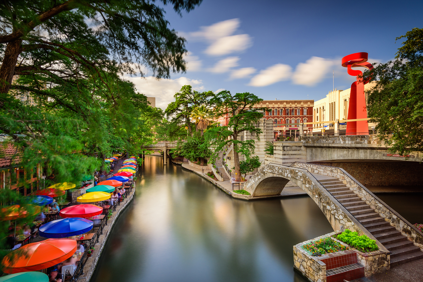
Name and Location: Brackenridge Park is a 323-acre public park located along the San Antonio River just north of downtown San Antonio.
History and Significance: Donated to the city in 1899 by philanthropist George W. Brackenridge, this historic city park provides open green space with recreation opportunities and iconic San Antonio attractions like the San Antonio Zoo and Witte Museum set alongside the riverwalk where the River Walk begins its loop.
What to Expect: Visitors enjoy walking/cycling trails, playground and picnic areas, sports fields, river access for fishing, train rides around the park and other family activities. Seasonal events and abundant heritage oak trees offer shade on hot days before exploring adjacent cultural destinations.
Visitor Information: Brackenridge Park is open daily 5am-11pm unless a special event is scheduled. Entry and parking within the massive park grounds are free. Nearby street parking surrounds its multiple access points off N St Mary’s St beyond I-35.
Serving as the crown jewel of San Antonio’s public park system, sprawling 343 acre Brackenridge Park sits just north of downtown along the Riverwalk Museum Reach. The park provides locals and tourists alike an urban escape with hike and bike trails, shaded picnic spots, historic sites, and cultural attractions all in one place. Visit the adjacent San Antonio Zoo, Japanese Tea Garden, or Witte Museum on the grounds. Take the kids to play mini-golf or ride the park railroad. Multiple sports facilities draw recreational leagues while the San Antonio River winds through it all. With so much to experience, Brackenridge Park offers a microcosm for the city’s diverse landscapes and activities.
Phil Hardberger Park
Name and Location: Phil Hardberger Park spans 311 acres northwest of downtown San Antonio at 8400 NW Military Highway adjacent to the Salado Creek Greenway Trail system.
History and Significance: Named after a former San Antonio mayor who spearheaded efforts creating this open gateway preserve abutting urban development, the park offers an oasis of woods, meadows and stream-fed ponds mixed with many amenities including playscapes, a Bark Park for dogs, fitness stations art installations and over 8 miles of multi-use trails.
What to Expect: Open vistas with views of downtown’s skyline, abundant wildlife sightings, ACCESSible trail loops for wheelchairs, geocaching adventures plus guided astronomy events and nature education programs engage visitors across this vast acreage catering to diverse interests through thoughtful recreational integration with natural beauty.
Visitor Information: The park is open daily 5am-11pm with free access and parking. Restrooms, drinking fountains and picnic facilities spread throughout grounds. Dog waste stations aid pick up enforcement preserving welcoming facilities.
Phil Hardberger Park showcases some of the most scenic Hill Country vistas and best hiking trails found inside San Antonio city limits. Spanning 300 acres across two locations along Salado Creek, residents flock to the park to walk dogs, trail run and enjoy picnics amidst gorgeous views. The Robert L.B. Tobin Land Bridge artfully connects the northern and southern sections over top Wurzbach Parkway. Ridgetop outlooks reveal rolling oak-dotted hills reminiscent of rural Texas while miles of multi-use paths cater to cyclists. Interpretive signage explains ongoing ecological restoration efforts too. For outdoor enthusiasts of all interests, Phil Hardberger Park’s scenic natural escapes thrill right in central San Antonio.
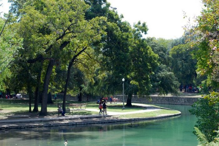
Woodlawn Lake Park
Name and Location: Woodlawn Lake Park lies 4 miles northwest of downtown San Antonio, encompassing 100 acres surrounding Woodlawn Lake at 1103 Cincinnati Ave not far from Fredericksburg Road and I-10.
History and Significance: Created in 1918 around a former water source reservoir built at the turn of the 20th century, this historic city park provides a popular urban wilderness escape convenient to downtown for romantic walks, family picnics, recreational fishing and paddling across the peaceful lake fringed by towering bald cypress trees.
What to Expect: Visitors traverse the 1.2 mile trail encircling the lake to admire abundant waterfowl and wildlife sightings, access pedal boat or kayak rentals seasonally while kids cavort at playgrounds before all ages enjoy cultural events ranging from movie nights to jazz concerts across the park’s iconic open-air bandstand during mild weather when the setting intoxicates under the stars.
Visitor Information: Free general access daily from 5am-11pm with extended hours some evenings for programmed events allowing sunrise to past sunset enjoyment of this convenient natural escape.
Offering families a downtown recreational oasis, Woodlawn Lake Park occupies impressive grounds just 2 miles from the Alamo. The park’s highlight rests on its peaceful namesake 20 acre lake, filled for boating, fishing and appreciating waterfowl. Walking trails surround the lake as do numerous picnic areas with grills underneath stately pecan and oak trees. Two playgrounds plus an off-leash dog park provide kids and pets plenty of room to roam too. Many visit Woodlawn Lake Park to admire the historic 1904 Woodlawn Lake pumphouse, now used as a cultural arts center. With abundant amenities amidst such a bucolic setting so close to central San Antonio, Woodlawn Lake Park entices everyone seeking outdoor escapes.
San Pedro Springs Park
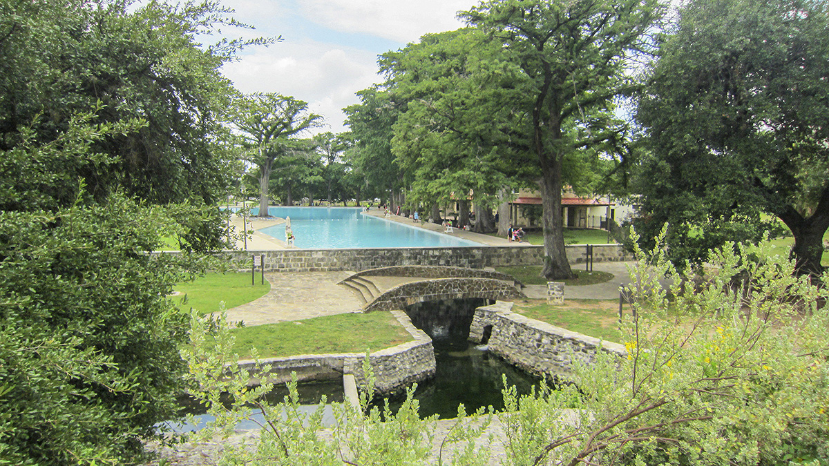
Name and Location: San Pedro Springs Park occupies 22 acres at 1315 San Pedro Ave, roughly one mile north of downtown San Antonio near I-35 and the access corridors of San Pedro Avenue and North Flores Street funneling drivers in from points beyond 1604 Loop perimeter highway enclosing the metro.
History and Significance: Originating as prehistoric indigenous grounds with evidence of almost 12,000 years of continuous human habitation based on artifacts unearthed onsite, the space later hosted initial Spanish settlement efforts along the vital headwaters feeding the San Antonio River before formally opening as Texas’ oldest park in 1852, today representing an archetypal community gathering grounds.
What to Expect: Families spread blankets under the plentiful shade trees dotting gentle hillsides while kids romp at two separate playgrounds bookending the grounds. Walking paths pass the historic San Pedro Playhouse community theater, public pool, and flowering gardens surrounding signature limestone spring pools named for Spanish royal family members that burble from below.
Visitor Information: Open daily 5am-11pm unless special events warrant extended hours. Nominal parking fees apply in designated lots off San Pedro Ave enabling easy access or take nearby VIA bus routes to this heritage city park.
While San Pedro Springs Park occupies only 22 acres in north central San Antonio, its historic significance remains enormous as the city’s first park and the second oldest continuously operating park in the entire United States since 1840. Today walkers enjoy strolling through towering heritage oak groves over lush lawns surrounding the Springs themselves which feed park lakes and swimming pools still in use. As the city’s first water supply, San Pedro Springs’ waters are mentioned in Spanish documents as early as 1729. Make a stop by the Jefferson Davis monument and Amphitheatre completed in 1945 by the Works Progress Administration too while exploring San Pedro Springs’ outsized heritage.
Pearsall Park
Name and Location: Pearsall Park is an 85-acre recreational park spanning 5102 Old Pearsall Rd in southwest San Antonio below I-410 near the intersection with SW Military Drive and SH-151.
History and Significance: Originally family ranch lands, the area was purchased by developers but faced financial troubles until Bexar County acquired and completed the park in the early 1980s, today operated by the city’s Parks and Recreation agency to provide community open space for gatherings and league sports including a public 18-hole golf course regaling players with views to downtown in the distance.
What to Expect: Multi-use trails encircle the park grounds, passing the golf course, public pool, lighted basketball pavilion, playgrounds and picnic facilities including reservable covered shelters amid scenic vantage points ideal for low-key family recreation with amenities to host birthday gatherings and friendly group functions under the sun or stars.
Visitor Information: Daily operations from 5am-11pm enabled by a patrol division. Some facilities like the batting cages and mini-golf course operate seasonal hours. Entry and parking available within grounds off Old Pearsall Rd or SW Military Dr.
Recreational options abound across Pearsall Park’s 148 acres in southwest San Antonio, creating an ideal destination for active families. Five baseball and softball fields host competitive leagues and tournaments year-round. Over five miles of multi-use trails provide space for runners and cyclists to cruise past picnickers barbecuing in one of 20 covered pavilions. The park contains four separate playgrounds plus a splash pad to keep kids entertained too. Visitors also enjoy feeding the ducks inhabiting Spring Lake. Historic significance rings through as well since Pearsall Park occupies land that was part of the historic Canary Islanders settlement during San Antonio’s inception. With so much going on, Pearsall Park buzzes as one of San Antonio’s recreational hubs.
McAllister Park
Name and Location: William McAllister Park encompasses 397 acres of rolling hills at 13102 Jones-Maltsberger Rd in northern San Antonio where Bitters and Starcrest roads intersect southwest of the US281 corridor above the Stone Oak neighborhoods near Hardy Oak Boulevard below 1604 beltway.
History and Significance: Acquired in sections by the city during the 1970s, park lands once operated cattle ranches before development into recreational amenities offering cycling routes and trail networks catering to mountain bikers plus remote control enthusiasts that pilot radio-controlled vehicles around off-road terrain courses continuing tradition of vehicular history associated with the property including tie to a role facilitating construction of early American automobiles.
What to Expect: Bikers shoot down single-track routes bookmarked by ramps and obstacles within the BMX downhill specialty track area while model aircraft buzz above in designated airspace safely separated from other park guests who traverse multi-use trails pastnative plants dotted with educational insights into local ecology and heritage livestock breeds grazing across these scenic acres fringing San Antonio suburbs.
Visitor Information: Standard access from 5am-11pm daily enabled through multiple entry points with free self-parking throughout grounds. Restrooms cluster near the Dennis R. Smith Mountain Bike Trail area and playground off Jones-Maltsberger Road.
Spanning a monumental 1311 acres in north San Antonio, Walter McAllister Park stands out for the extensive trail system windy through hilly wooded areas with intermittent creek crossings. Miles of multi-use trails provide routes for mountain bikers, trail runners and horseback riders amidst supremely scenic surroundings. Many visitors come to hike the Red Loop Trail leading high onto exposed Limestone bluffs revealing panoramic San Antonio skyline views. Covered pavilions and playground areas welcome families for full afternoons outside too. And with a dedicated 240 acre off-leash dog area within the park, even furry friends enjoy exploring everything McAllister Park’s vibrant landscape offers just minutes from the city.
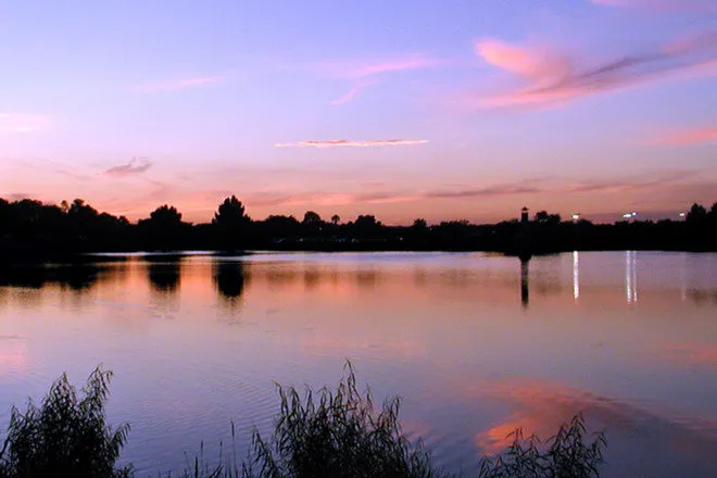
Confluence Park

Name and Location: Confluence Park lies west of downtown San Antonio along the San Antonio River at the junction of three waterways – the San Antonio River, San Pedro Creek, and Alazan Creek – that merge near I-35 and Commerce Street slightly south of I-10 overpass.
History and Significance: Created through the San Antonio River Improvements Project transforming waterway aesthetics and recreational access, this park’s evocative name describes the convergence of key water sources nurturing San Antonio growth across time with location echoing its influential role in local history as settlements gravitated around these live-giving springs and headwaters powering development.
What to Expect: A haven of public art honoring cultural diversity and hardy native wildlife greets visitors at this ecological and symbolic heart of the city secured from flood damage threat. They traverse landscaped walking paths and gathering plazas along gently sloping banks ideal for taking in panoramas of downtown from waterside promenades accented by decorative bridges, fountains, and educational heritage markers.
Visitor Information: Free access daily 6am-11pm. Parking garages flanking west Commerce Street near River Walk ingress points service visitors. Stroller/wheelchair-friendly paved pathways accommodate all mobility levels throughout its manicured acreage.
Resting along San Pedro Creek Culture Park just west of downtown, innovative Confluence Park transformed a neglected parcel of land into an urban oasis celebrating San Antonio’s natural and cultural roots. Visitors walk over reclaimed limestone blocks past Native American inspired public art and intricate decorative water features that imaginatively interact with runoff. Keep an eye out for inscribed quotes from noteworthy historic San Antonio figures too. During the day, dancing water jets entertain gleeful kids while at night, creative lighting beneath the canopy of mature live oaks sets the atmosphere. As the central meeting spot for the city’s historic acequia system, Confluence Park fittingly showcases the harmony of flowing water, inspired design and rich heritage.
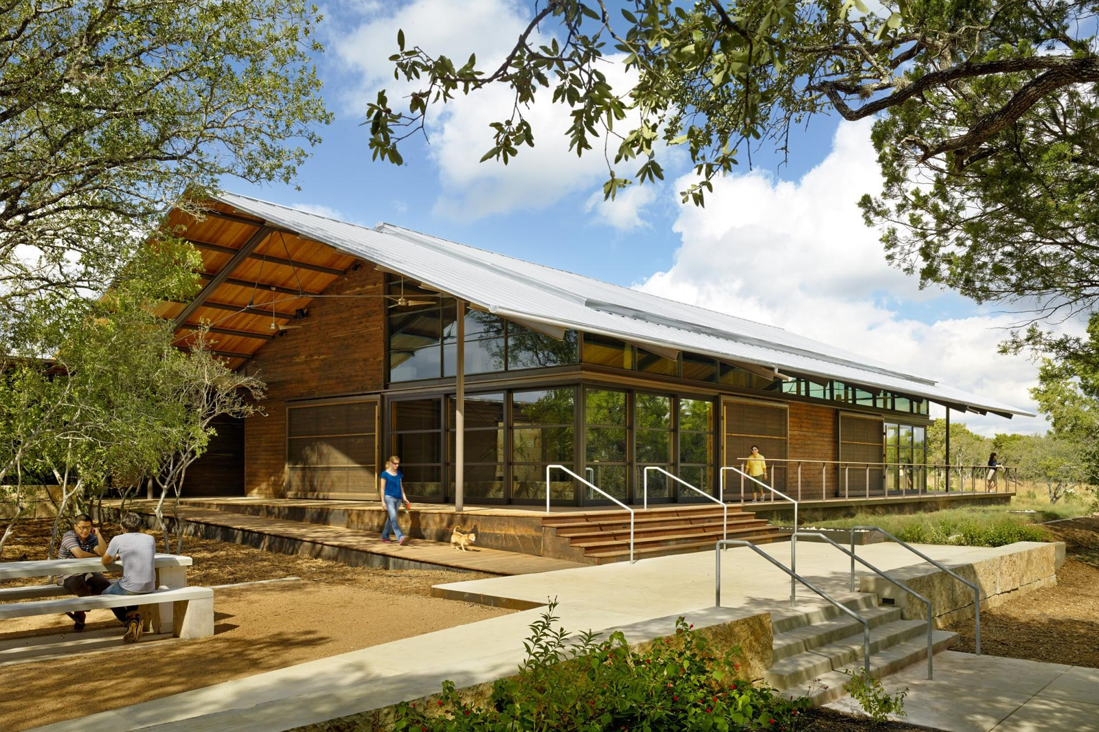
OP Schnabel Park
Name and Location: O.P. Schnabel Park rests along the shores of Leon Creek crossing Bandera Road in northwest San Antonio within the city limits approximately 16 miles outside of downtown near the intersection with Huebner Road inside 1604 “Loop” perimeter highway.
History and Significance: Bearing the namesake of Oliver P. Schnabel – a former Bexar County Commissioner dedicated to preserving precious greenbelt spaces despite rising land values during San Antonio’s growth boom – public recreational facilities opened in 1985 from private holdings once operated as cattle ranchlands fronting the spring-fed creek.
What to Expect: Cyclists zip along trails weaving through tall trees and over creek crossings passing limestone bluffs while others learn the sport on a dedicated pump track circuit or test skills at the dual slalom course. Shady pavilions accept gatherings with amenities like volleyball courts and a roller hockey rink rounding out active options around this 208-acre playground.
Visitor Information: Open daily 5am-11pm with access off Bandera Rd. Leashed pets allowed in certain areas. On-site security presence with parking along interior roads plus nearby public transportation options leading to the park.
Encompassing over 100 acres within northwest San Antonio, OP Schnabel Park delivers convenient access to the scenic Texas Hill Country terrain and the renowned Leon Creek Greenway trail system. Several miles of multi-use trails traverse underneath mature oak trees and along spring-fed creek branches. Cyclists, walkers and trail runners share routes leading into adjoining parks. The park’s namesake OP Schnabel Ranch House now operates as an event venue and education center surrounded by native demonstration gardens. Kids burn energy across two different playgrounds while families bond over backyard games. With so many amenities including bathrooms and water fountains, OP Schnabel Park’s well-developed grounds ensure convenient Hill Country escapes.
Friedrich Wilderness Park
Name and Location: Friedrich Wilderness Park spans across 655 acres of native landscape 25 miles north of downtown San Antonio off LaCantera Parkway near the intersection for Hardy Oak Blvd below I-10 corridor at 13530 Highway 1 West.
History and Significance: Operated as cattle ranchlands in the mid-19th century before residential development encroached nearby prompting Bexar Land Trust acquisition aimed at managing this scenic acreage as ecologically-sensitive parkland where visitors immerse in natural habitat offering sanctuary to wildlife and native plants enduring relatively untouched across various ecosystems ranging from rocky overlooks to wetland environs.
What to Expect: A haven for outdoor enthusiasts and nature lovers, over 6.5 miles of multi-use trails rise across ridges revealing breathtaking vistas where possible wildlife encounters might include views of herds of elk or wild turkeys foraging under canopy cover. Interpretive educational elements accent certain routes conveying conservation insights.
Visitor Information: Accessible free daily 5am-8:30pm off La Cantera Pkwy. Leashed pets allowed. Parking available at Canyon Ranch Trailhead with portable restroom facilities onsite. Terrain varies so prepare proper footwear for treks planned.
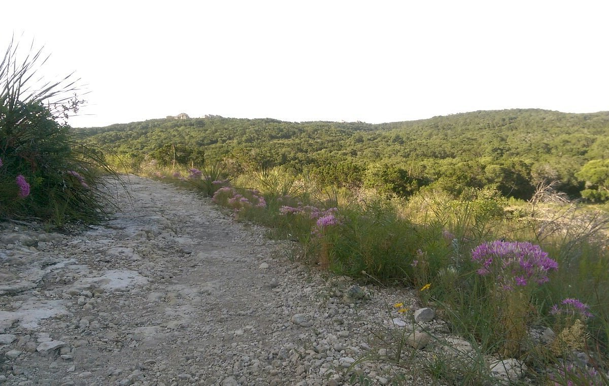
Spread across the scenic northern San Antonio hills, stunning Friedrich Wilderness Park spans 655 acres loaded with picturesque views and over 10 miles of multi-use trails winding through oak savannas and dense juniper groves. Most visitors come specifically to hike the park’s trails, including the Interpretive Trail Loop which is accessible for wheelchairs and strollers too. Parents with kids frequent The Hidden Village, an imaginative playground with folklore themes that feels a world away despite sitting right inside city limits. Seven distinct plant communities across Friedrich Wilderness Park make for superb spring wildflower viewing as well. For equestrians, trail access links across adjacent parks too. With so much natural beauty, Friedrich Wilderness Park exemplifies San Antonio’s scenic backyard.
Mission Reach Paddling Trail
Name and Location: The Mission Reach Paddling Trail runs 8 miles along the San Antonio River south from downtown through historic San Antonio Missions National Historical Park. Public access launch sites at Padre Park. Espada Park, Mission San Juan, and Mission Espada enable experiences.
History and Significance: Part of San Antonio River Improvements Project enhancing habitat, recreation and flood control along waterway banks, this paddling route allows boaters of all ages immerse amid vestiges of Spanish aqueducts through wild riparian terrain rich in wildlife while floating past UNESCO World Heritage sites tracing 300 years of multicultural settlement back to first European incursion into the region.
What to Expect: Kayakers, stand up paddleboard enthusiasts and leisurely tubers embrace gentle currents passing historic missions and traversing rushing shoots through woodland passages pristine despite urban proximity culminating at Espada Dam before return transport rides ferried by outfitters who rent equipment deliver adventures catering interests from history buffs and nature nuts to easygoing families simply spending time together appreciating idyllic vistas slide by at this aquatic pace.
Visitor Information: Launch points offer parking and transports operators for float duration options from hours to days crossing the 15 miles to Mitchell Lake. Day use fees fund ecological efforts. Download maps detailing optimal put-ins based on ability and sightseeing.
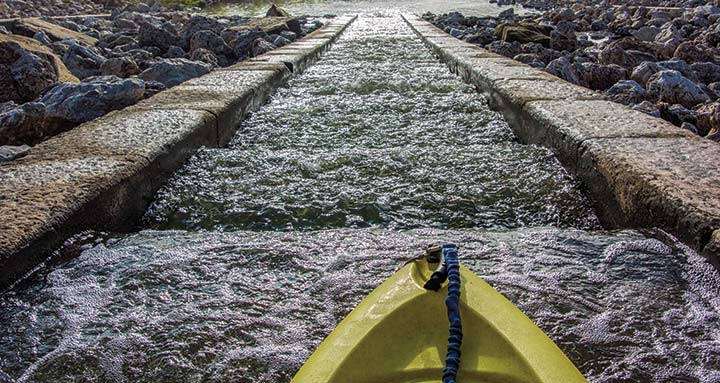
Combining multiple attractions across south central San Antonio, the Mission Reach Paddling Trail runs eight miles along the San Antonio River from downtown through Lone Star Brewery to Historic Mission Espada. This National Recreation Trail ranks as one of the most popular urban paddling routes in the country, connecting the iconic Riverwalk to the historic San Antonio Missions via vibrant park spaces. Kayaks, rafts, paddleboards and more cruise underneath bald cypress trees and limestone cliffs while admiring Concepción, San José, San Juan and Espada Missions established 300 years ago. Public art installations add pops of color everywhere too. For first-time visitors and longtime locals alike, the Mission Reach Paddling Trail immerses you in quintessential San Antonio scenery.
Comanche Lookout Park
Name and Location: Comanche Lookout Park lies 13 miles north of downtown overlooking San Antonio Hill Country greenspace along the Nueces River basin off Dresden Drive adjacent to FM1957 and Rick Smith Memorial Park near the township of Hollywood Park.
History and Significance: Unfolding across former ranchlands whose namesake summit once served as vintage lookout spot to monitor Comanche tribe movements, Travis Kessler donated partial holdings to establish public parkland in 2017 honoring the natural heritage and rustic beauty characterized by native flora clinging to an escarpment’s rocky contours above the rural topography visible to appreciative visitors from scenic vistas.
What to Expect: Intrepid hikers mount stairways to the pinnacle absorbing panoramic scenery from the ledge, while families below traverse short nature loops to admire wooded ravines and seasonal wildflower blooms spread below allowing immersion into the outdoors minus leaving bustling metropolitan energy trailing only minutes behind at this Hill Country portal.
Visitor Information: Leashed pets allowed across 232 acres open daily 5am-11pm with hiking trail access from Dresden Drive including parking accommodations, restrooms and trash facilities supporting maintenance for $3 entry fee required per visitor during return trips.
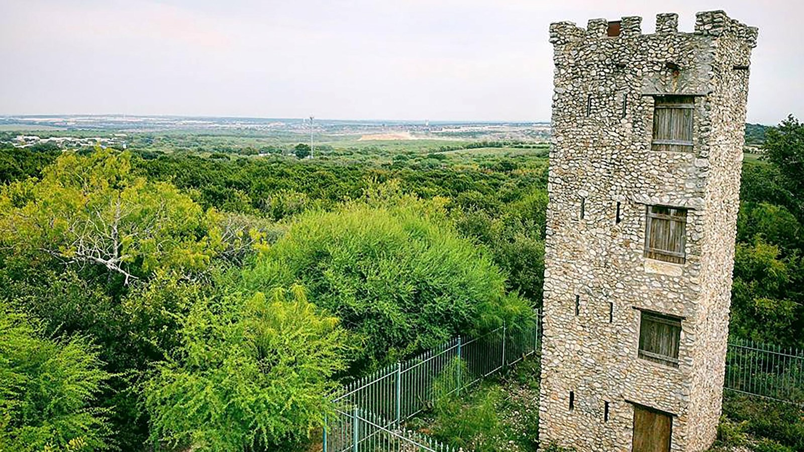
Perched atop a high limestone cliff on San Antonio’s northeast side, Comanche Lookout Park treats hikers to supremely scenic Hill Country vistas unlike anywhere else in the city. Ascend over 400 ft in elevation to the park’s overlook deck for a stunning 180 degree panorama stretching across downtown and into Texas Hill Country. The view looks especially impressive at sunset when the sky lights up brilliant hues of orange and pink. Eagle-eyed observers can spot the Tower of Americas and University of Texas- San Antonio campus too. Miles of scenic hiking trails weave through the oak savanna and juniper canyonland below as well, giving adventurers front row seats to the unique landscape. For incredible views close to town, Comanche Lookout Park certainly delivers.
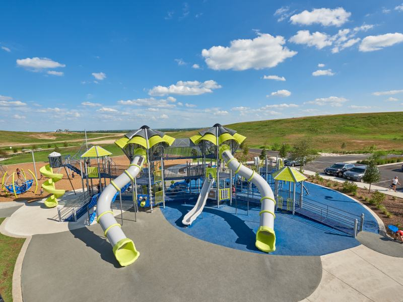
HemisFair Park
Name and Location: HemisFair Park spans 96 acres at 445 S Alamo Street in downtown San Antonio bordered by Cesar Chavez Blvd to the west, Market Street to the north; Alamo St on the east and Durango Blvd along its southern extents.
History and Significance: Site of the 1968 World’s Fair, the space commemorates history while revitalizing as an active urban green space supporting events and cultural touchstones including the iconic Tower of the Americas observation pillar still anchoring attractions. Ongoing redevelopment furthers park purpose as a central civic gathering place improving connectivity across downtown.
What to Expect: The Promenade anchors foot traffic through fountains, lawns and pavilions linked to landmarks like the historic carousel, Yanaguana Garden children’s playground while the Convention Center and Institute for Texan Cultures provide added magnetism now augmented by restaurants, housing and an open-air pavilion known as Confluence Park trying to create a dynamic 24-hour neighborhood matching the vibrant heritage binding this rectilinear parcel firmly to San Antonio’s identity.
Visitor Information: Open daily means exploring grounds is freely accessible to all visitors during any hour while specific features adjust operations seasonally. Parking access stems from bordering street-front pay lots/garages. Walking or public transport remain reliable methods for reaching zone easily.
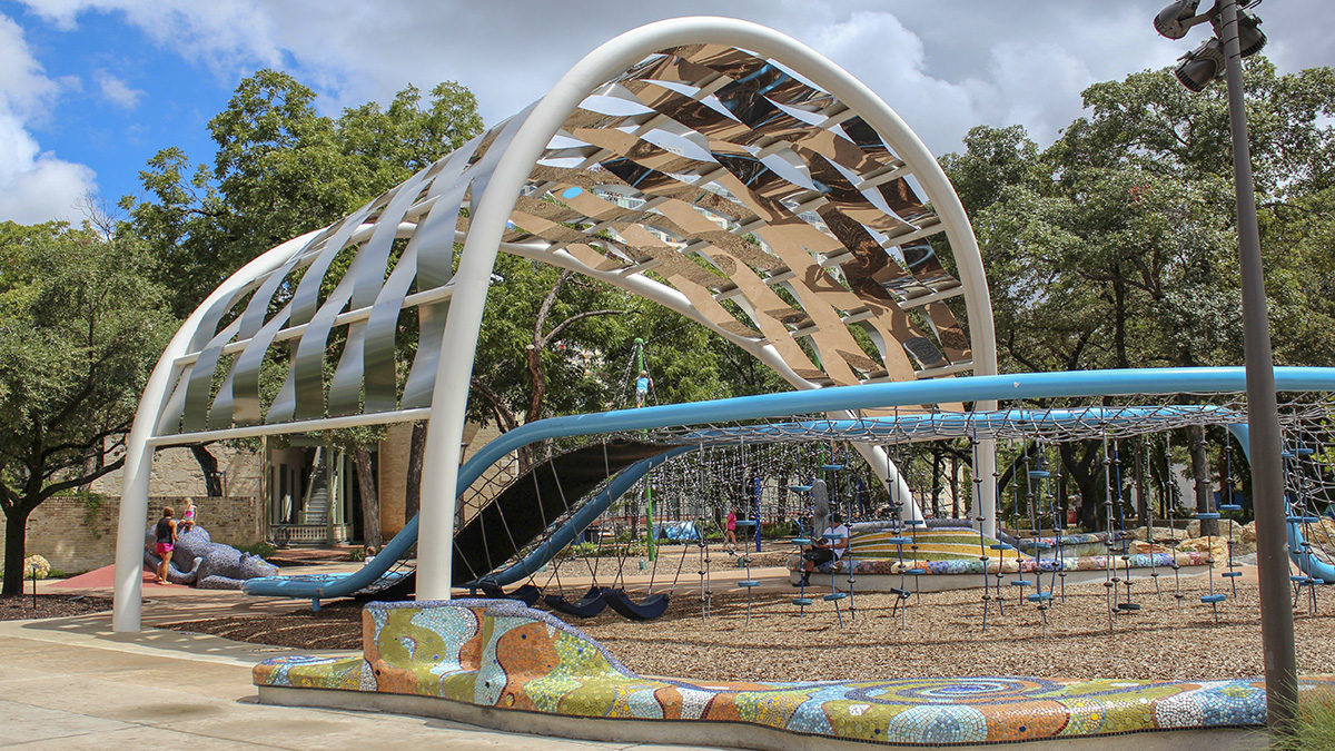
Packed full with family fun, attractions, and easy Riverwalk access in central downtown San Antonio, HemisFair Park boasts a prime location neighboring the iconic Tower of the Americas. The 50 acre park transformed from hosting the 1968 World’s Fair into a modern central gathering space filled with playgrounds, interactive water features, public art, and open lawns for catching concerts. Shaded walking paths underneath spreading oak trees link to kid favorites like the Yanaguana Splash Pad and Play Escape. Active adults come for exercise classes on the lawn or to play sand volleyball on site too. As home to major annual events in San Antonio like Fiesta, Hemisfair Park celebrates everything that makes the city vibrant.
So whether seeking historic sites, running trails, waterfront access or family playgrounds, San Antonio’s top parks offer something for all interests. Beyond the city’s iconic downtown Riverwalk and cultural attractions, San Antonio commits over 15,000 acres of public park spaces for enjoying quintessential Texas Hill Country scenery, recreation programming, and so much more. From manicured urban gardens to sprawling preserve wilderness, San Antonio parks enhance vibrant community bonds that give the city its welcoming southern charm. For tourists and residents alike, make San Antonio’s top parks part of appreciating everything that makes the city so memorable to visit.