
Beyond endless palm-lined golf courses and resort poolsides, Phoenix offers superb hiking across diverse desert terrain that beckons adventurous visitors. With over 41,000 acres of mountain preserves and parks scattered across the Valley of the Sun, hitting the rugged trails proves essential for appreciating Phoenix’s awe-inspiring natural landscapes distinguished by towering saguaros, fragrant creosote bushes and plenty of cacti.
| Trail Name | Description |
|---|---|
| Camelback Mountain | Iconic, challenging hike with city views. |
| Piestewa Peak | High city point with extensive views. |
| South Mountain Park | Large park with diverse trails and city vistas. |
| North Mountain National Trail | Moderate hike with panoramic views. |
| Sunrise Peak | Steep trails with exceptional dawn views. |
| Pinnacle Peak Trail | Scenic trail in Scottsdale with elevation gains. |
| Peralta Trail | Superstition Mountains hike with varied scenery. |
| Hidden Valley Trail | Easy trail through typical desert landscape. |
| Quartz Summit Trail | Moderate trail with sweeping vistas. |
| Lookout Trail – South Mountain | Gradual elevation, family-friendly. |
| Hieroglyphic Trail | Ancient art and desert views in Superstition Mountains. |
| Margies Cove Trail | Secluded trail with unique desert features. |
From easy nature walks to strenuous summit climbs delivering 360 degree views, make sure to lace up your boots for these 12 best Phoenix hiking trails showcasing quintessential Sonoran scenery.
Camelback Mountain

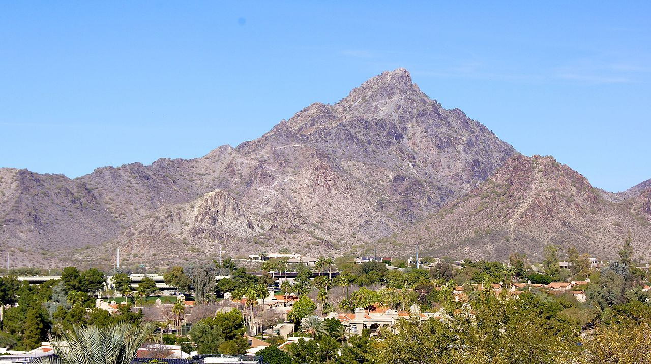
Name and Location: Camelback Mountain is an iconic 2,704 ft mountain located in Phoenix, Arizona between the upscale Paradise Valley and Scottsdale neighborhoods.
History and Significance: Named because it resembles a kneeling camel, Camelback Mountain is a popular yet demanding summit hike with two trails leading up the peak showcasing panoramic city and valley views.
What to Expect: Steep, rocky terrain with handrails and benches. No water sources. Choice between the very challenging Cholla Trail and the more gradual Echo Canyon Trail. Spectacular views from the top.
Visitor Information: Open daily sunrise to sunset. Limited parking so arrive early. Pack plenty of water. Not recommended for novice hikers.
Without question Phoenix’s most iconic hike, Camelback Mountain draws hundreds of hikers and rock climbers daily to its summit. Located centrally near luxury resorts and downtown, the strenuous climb ascends 1,280 feet over only 1.2 miles of rocky terrain rugged enough to feel like a real wilderness adventure despite the urban backdrop down below. While a challenging scramble requiring scrambling on all fours in sections, successful hikers gain immense views across Phoenix and Scottsdale from the peak for unparalleled sunrise vistas. Just prepare properly with gloves, lightweight clothing and sturdy shoes because as locals love warning – Camelback Mountain is not for sissies!
Piestewa Peak
Name and Location: Piestewa Peak towers 2,610 feet as part of the Phoenix Mountains Preserve offering rigorous hiking trails with rewarding views northeast of the city.
History and Significance: Originally Squaw Peak, its renaming after fallen Native American soldier Lori Piestewa recognizes Arizona’s second highest point as an iconic summit with panoramic valley views.
What to Expect: Challenging uphill hiking options ranging 1.2 to 2.4 miles over 1100 ft ascent through Sonoran Desert terrain leading to stellar vistas across Phoenix below with multiple rocky peaks to summit behind colorfully graffitied boulders.
Visitor Information: Two main trailheads fill early. Arrive before 8 AM. Carry water/dress appropriately for intense daytime heat on shadeless inclines peaking around 2700+ ft.
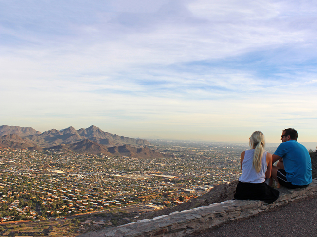
Soaring to over 2,600 feet, Piestewa Peak within the Phoenix Mountain Preserve stands as the second highest point within any American city after nearby Camelback Mountain, offering even more sweeping views across the enormous metropolis from its exposed summit. Over 5 miles of branching trails snake across the lower foothills cactus forest making it popular with mountain bikers, while sunrise hikers take either the moderate Nature Trail or steep Summit Trail straight upwards. Thanks to elevation gain over 1,200 feet, heart rates accelerate just as fast as the panorama expands atop Piestewa Peak. Reward all the effort by admiring how tiny downtown Phoenix appears and spotting your resort below.
South Mountain Park
Name and Location: Spanning over 16,000 acres, South Mountain Park contains over 50 miles of trails south of downtown Phoenix showcasing native desert scenery.
History and Significance: Established in 1924, trails across its Sonoran Desert ecosystem lead hikers to ancient Hohokam petroglyphs, scenic lookouts and an abundance of desert flora and fauna.
What to Expect: A wide spectrum of trail difficulties ranging from easy nature walks less than a 1/2 mile to the challenging 15.3 mile National Trail leading past granite walls decorated with prehistoric rock art.
Visitor Information: Open daily from sunrise to sunset. Some trailhead parking lots close earlier in the evenings. Bring plenty of water and prepare for desert conditions.
At over 16,000 acres, South Mountain Park contains extensive hiking opportunities traversing preserve foothills and weaving along ridgelines dotted with saguaros – home to petite cactus wrens – for over 50 miles. But most hikers beeline towards Dobbins Point delivering astonishing city views by ascending the National Trail – a 3 mile loop gaining 1,000 feet elevation capped with tremendous perspective. Sections do require some basic rock scrambling but nothing as extreme as Camelback or Piestewa Peaks. Connector trails then can link over to Mormon or Holbert for grand vistas across iconic landmarks like downtown Chase Field and Tempe Butte before looping around through the cactus forests back to the trailhead.
North Mountain National Trail
Name and Location: The North Mountain National Trail is a wide 15+ mile trail along the northern stretch of the Phoenix Mountain Preserve with various access points.
History and Significance: Initially serving as a historic route used in the late 1880s, today the trail system challenges avid city hikers looking for peaceful solitude and impressive vistas across horas of traversing ups and downs amidst typical Sonoran vegetation.
What to Expect: Long distance hikers pass shaded pockets and water sources while ascending over 1000 feet along winding sustained stretches before being rewarded with excellent views in all directions with fewer crowds than most other regional peaks.
Visitor Information: Multiple access points with limited parking. Park hours 5am-11pm. Bring plenty of water/preparation to completely isolate for durations over 7 strenuous desert miles.
Sister summit to camelback Mountain across town, North Mountain delivers similar outstanding panoramas overlooking Phoenix from its windy crest for less crowds and still only moderate difficulty thanks to a smoother wider path towards the top through Sonoran vegetation. The trail stretches almost 4 miles roundtrip but payoff vistas across to Camelback Mountain and even Sedona’s red rocks appear otherworldly beautiful as city high-rises shine far below on the valley floor. Cooler early morning temperatures make the 350 feet elevation gain hike up North Mountain’s National Trail more pleasant before photo ops admiring towering saguaros emerging around you with downtown glistening beyond like a mirage along the horizon.
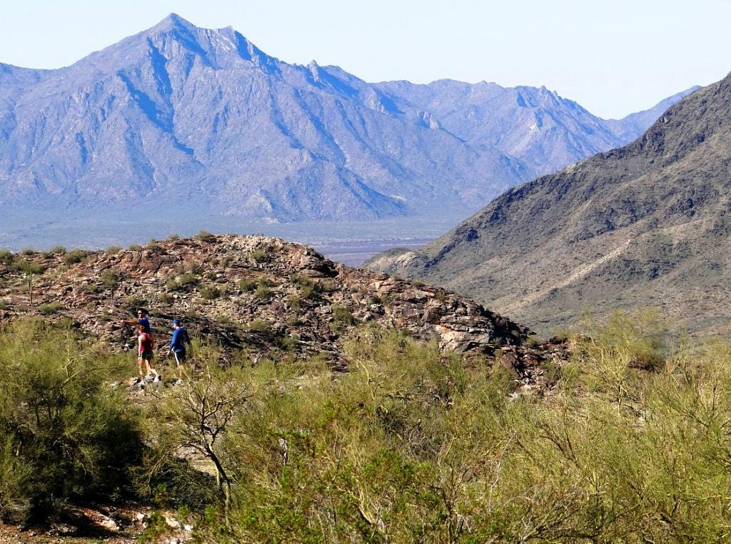
Sunrise Peak

Name and Location: Sunrise Peak stands at 1,500 feet within Phoenix’s North Mountain range offering quick short hikes to panoramic views northeast of the city.
History and Significance: A small offshoot summit of North Mountain with even larger Shaw Butte neighboring it, the rocky outcropping provides a less crowded alternative hike compared to other valley destinations rewarding exertion from its summit with sweeping scenery.
What to Expect: Under a mile up packed dirt on a steep but direct ascent, the uneven path gives way to an uninterrupted 360° perspective of Paradise Valley below with the option to continue along connectivity to longer regional trails.
Visitor Information: Year-round entry sunrise to sunset. Limited roadside parking. No facilities or shade on trail itself which climbs 650 feet rapidly over less than a 1/2 mile.
Although overshadowed both literally and figuratively by Camelback Mountain next door stealing most fame, Sunrise Peak boasts less crowded yet still exceptional hiking across significantly steeper switchbacks leading towards one of Phoenix’s most dazzling panoramas at 2,808 feet elevation. Shorter yet more demanding than Camelback, expect full body workout climbing the 2400 feet elevation gain over 3 miles up Sunrise’s rugged terrain. The aptly named summit rewards supreme dawn views streaming across Paradise Valley matched with unique perspective peering down upon Camelback Mountain now appearing petite and shadowed by your height. Just beware that Sunrise Trail contains crumbling sections requiring actual rock climbing skills not found on most Phoenix paths. But views stretching to North Scottsdale and Four Peaks wilderness beyond make conquering Sunrise Peak incredibly satisfying.
Pinnacle Peak Trail
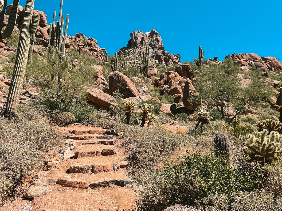
Name and Location: The Pinnacle Peak Trail is a moderately challenging hiking trail ascending over 1,300 feet in under 2 miles to the flattened rocky summit of Pinnacle Peak located near North Scottsdale.
History and Significance: Originally named Bull Hill by explorer Charles Wilson, locals eventually dubbed the granite domed summit Pinnacle Peak which tops out at 3,169 ft. delivering excellent panoramic views, earning popularity for hiking and climbing day trips.
What to Expect: Marked by rocky switchbacks threaded between boulder formations first through hillsides then mounting the incline up the peak’s western slope, the steady climb rewards exercisers young and old completing it.
Visitor Information: Daily operation from sunrise to sunset. Parking fills early. Trailhead facilities offer restrooms, water spigots and information kiosks preparing hikers for the hearty uphill trek.
Head north to hike this aptly named trail in Scottsdale’s Pinnacle Peak Park, which summits after 1.75 miles at over 3,100 feet elevation gazing down steep cliffs. While short, the trail gains 600 feet rather rapidly at some lung-busting grades. But families still flock to Pinnacle Peak’s iconic western facade capped by granite spires for sunrises, sunsets and always Instagrammable scenery. Just be prepared for early wake-up calls to secure trailhead parking. Panoramas peer deep across Fountain Hills and Mazatzal Mountains for true sense of sprawling scale. Bring sure-footed shoes too for a few brief rock scrambling sections hoisting yourself uphill before more moderate graded switchbacks appear approaching the saddle junction. Whether a visitor, local or hard-core hiker, Pinnacle Peak always satisfies.
Peralta Trail
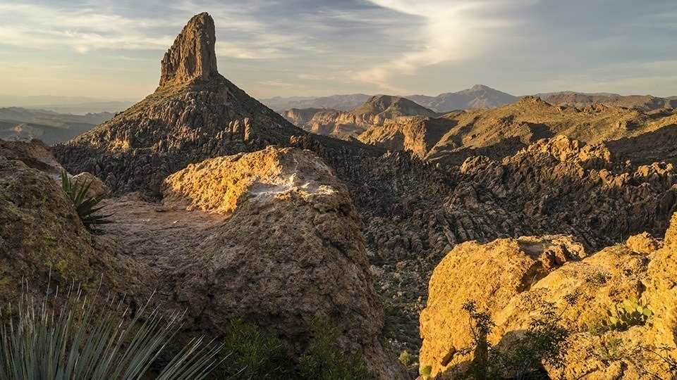
Name and Location: Situated within the Superstition Wilderness, the difficult 8-mile Peralta Trail winds deep into canyon country below the towering flatiron cliffs of Weavers Needle finally arriving at remote Peralta Canyon.
History and Significance: Used by native tribes like the Apache, tales of lost gold led “Dutchman” Jacob Waltz to allegedly stash a mythical motherlode linked today to this trail’s namesake canyon deep within the otherworldly Superstition ridgelines.
What to Expect: Steadily dropping 2000 feet over challenging terrain into the heart of mesa walls concealing hidden watering holes, the mystique of rumored lost mines still lures adventurous hikers on the multi-hour trek seeking gold, solitude and scenery.
Visitor Information: Accessible by SUPerstition Wilderness pass. Considerable distance and difficulty often deter casual hikers from its draw beyond Weaver’s Needle vista. Not recommended for summer months or novice outdoorspersons.
Hidden on the eastern Superstition Mountains flank, this trail leads through towering canyon cliffs, desert washes and even segments of shade; rare for Arizona hikes. The diverse scenery captivates over 6 spectacular miles reaching into wilderness solitude that transforms seasonally from lush spring wildflowers to striking cactus blooms before eventually achieving sweeping views towards iconic Weavers Needle giant monolith. Along the way, pass through ancient collapsed mining tunnels now exposing scenic rocky frames for blue sky portraits. While the complete 16 mile roundtrip hike crosses challenging terrain beyond most fitness levels, going at least 2.5 miles towards Fremont Saddle captures the best highlights of majestic mountains, high desert topography and far-reaching vistas that make Peralta Trail so special.
Hidden Valley Trail

Name and Location: The Hidden Valley Trail travels gradually uphill just over 2 miles to secluded rock features tucked amidst the granite walls deep inside South Mountain Park south of downtown Phoenix.
History and Significance: Used for centuries by native tribes like the Akimel O’odham evidenced by glyphs along its path, the unique landscape concealing the valley still provides isolation, moderate challenge and intrigue accessed conveniently from central Phoenix trailhead gates.
What to Expect: After crossing modest desert terrain, the rocky valley emerges inviting exploration over, around and between smooth eroded granite as hikers discover earth-carved contours revealing alternative perspectives across familiar seen and unseen cityscapes.
Visitor Information: Park opens at 5 AM, closing at 7 PM with last entry at 6 PM. Parking passes required. Seasonal heat demands proper hydration and attire. Trail rated moderate difficulty.
Connected to some of South Mountain’s loop trails off Baseline Road, Hidden Valley offers pleasant hiking across 3.8 miles through typical Sonoran Desert scenery with options to traverse neighboring trails for different perspectives of the broad preserve. The path itself undulates gradually over and around desert foothills without major elevation changes, allowing pleasant walking while spotting vibrant beavertail and hedgehog cacti dotted with crimson flowers in spring. At the turnaround point, a small valley lined with saguaros indeed does appear “hidden” from other views across Phoenix. While not overloaded with panoramic payoff, Hidden Valley presents quintessential desert hiking through forests filled with towering cacti, blooming ocotillo plants and rocky dry river beds revealing nature’s intricate beauty.
Quartz Summit Trail
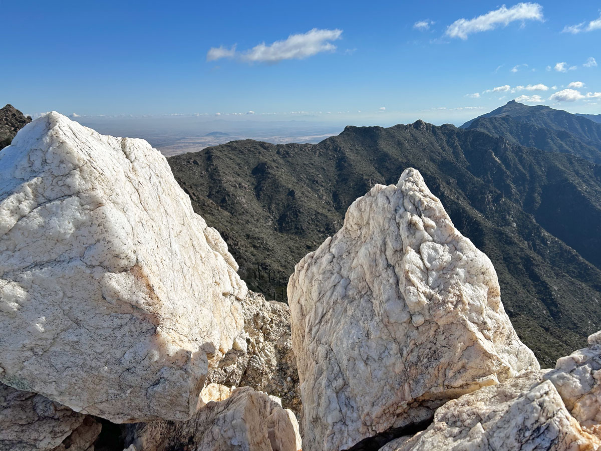
Name and Location: The Quartz Summit Trail is a 3 mile out and back hiking trail to a small mountain peak located within the McDowell Sonoran Preserve north of Scottsdale.
History and Significance: Named for deposits of gold bearing quartz found in the area by settlers in the 1800s, the landscape still yields panoramic views across business parks and luxury homes occupying lands below for hikers pushing to its upper ridgeline.
What to Expect: A relentless incline gains 1200 feet from trailhead to summit over unrelenting switchbacks threaded through stands of saguaro, juniper and Palo Verde taking most hikers 1.5-2 hours to complete at moderate intensity.
Visitor Information: Accessible year-round from sunrise to sunset. Parking permitted on shoulder. No facilities along ascent over considerable elevation ending suddenly atop rocky plateau.
Just 15 minutes drive north from downtown Phoenix off I-17 near Anthem, the extensive trail system of Daisy Mountain and Black Mountain weaves for over 30 miles above desert washes punctuated by saguaro cactus scenery. The Quartz Summit Trail makes for ideal introduction covering just under 6 miles out-and-back with moderate elevation gain towards wide sweeping views into rural outskirts of Phoenix. Walk through fields of fiery ocotillo plants and brush up against spiny jumping chollas before conquering the Manzanita Point lookout to spot your first glimpses of distant city skylines. Quartz Summit then emerges suddenly after a steep push, revealing even broader vistas northwards across undeveloped Tonto National Forest stretching towards Payson’s Mazatzal Mountains – a supreme hidden hiking reward astonishingly close to urbanization.
Lookout Trail – South Mountain
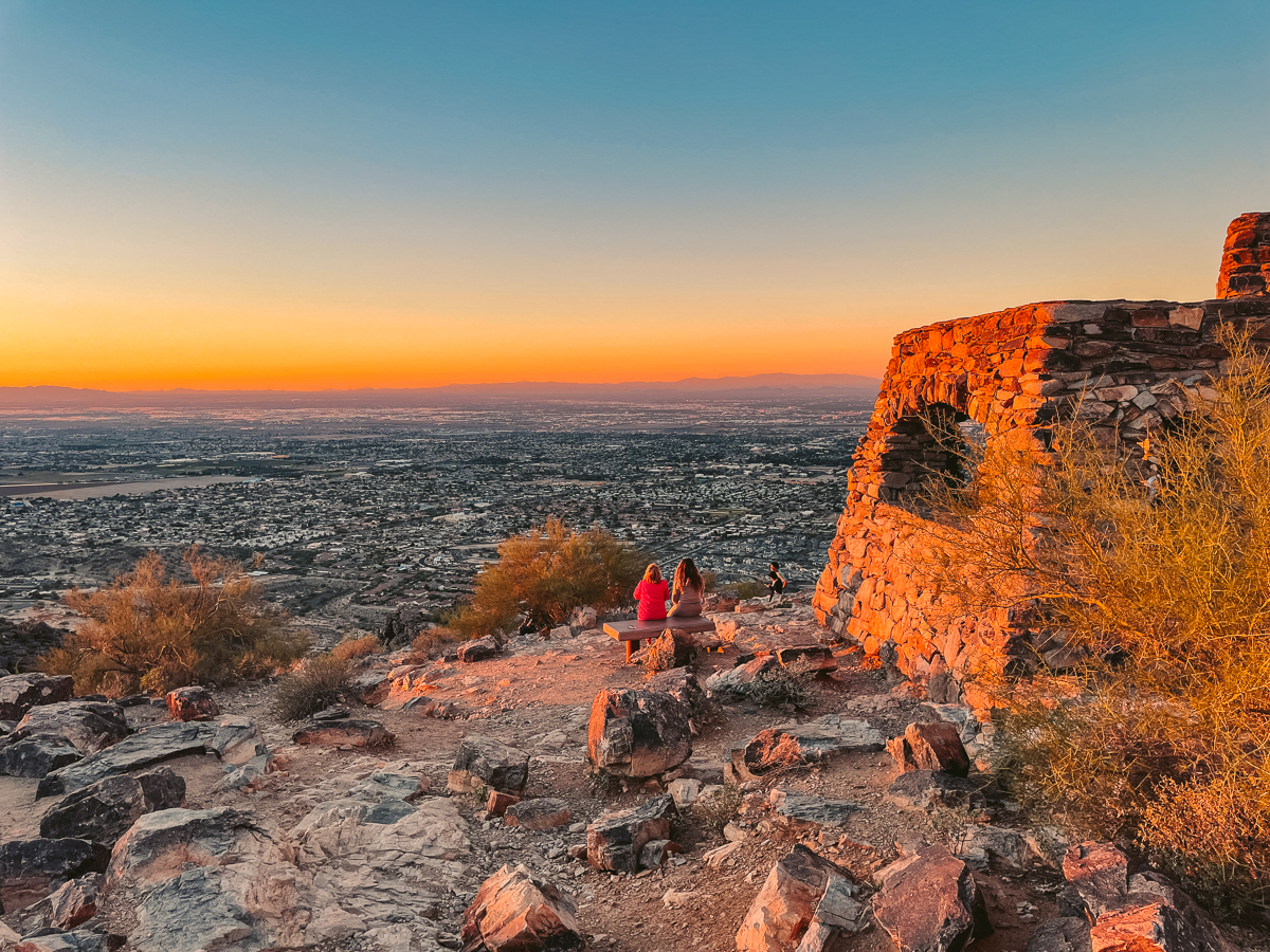
Name and Location: Lookout Trail in South Mountain Park is a steep 1.5 mile trail leading hikers uphill to Dobbins Lookout – an elevation of 2,330 feet showcasing sweeping views north across Phoenix, Scottsdale and Paradise Valley.
History and Significance: Created in 1913 for Model T access, Dobbins Road and Trail have continued providing sightseers dramatic elevated views as Phoenix eventually grew around the sentinel South Mountain peaks framed clearly from Dobbins panoramic perspective.
What to Expect: An aggressive uphill hike on a well marked path quickly gains elevation through switchbacks passing picnic sites along the way leading to an expansive overlook with information plaque detailing history and visible landmarks.
Visitor Information: South Mountain Park access 5am-7pm. Road gate closes at sunset. No park facilities nearby. Water and appropriate footwear recommended for steep exposed aspects on trail rated difficult.
Although its name sounds unimaginative, South Mountain’s Lookout Trail still impresses thanks to solitude and slower pace than the popular National Trail alongside. Built from volunteer efforts, the Lookout Trail contrasts more gradual elevation profile that families appreciate while winding through signature saguaro cactus scenery over creosote-dotted terrain. The path stretches almost 6 miles roundtrip onto a saddle granting therapeutic views across south Phoenix and downtown skyscrapers. For shutterbugs, early morning light casting shadows off giant cactus makes for dramatic portraits with city backdrop. And for trail runners, connecting Lookout Trail with National Trail’s loop creates the perfect half marathon distance across SOMO’s immense 16,000 acre landscape – an iconic South Mountain experience rivaling any road race.
Hieroglyphic Trail – Superstition Mountains
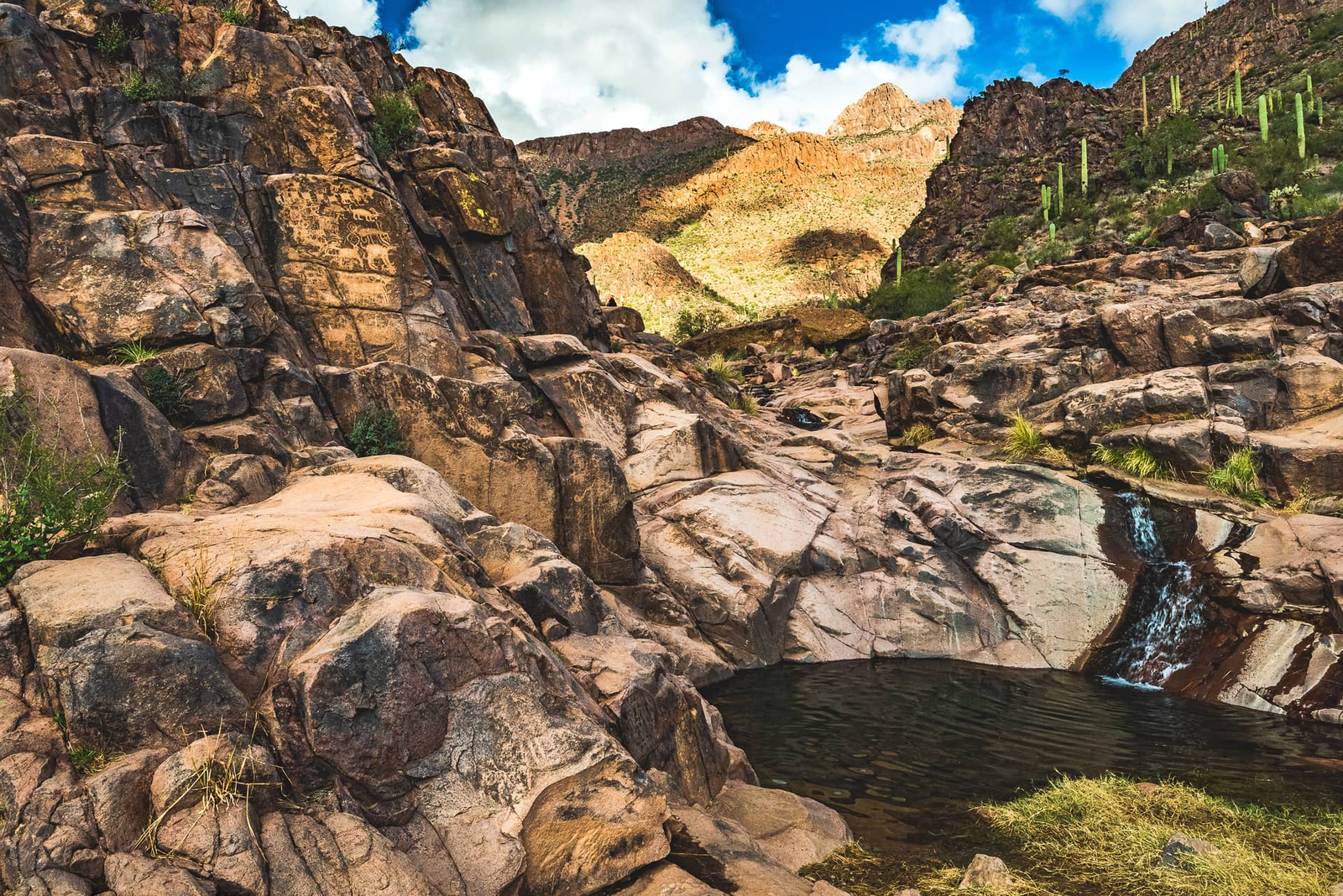
Name and Location: The Hieroglyphic Trail traverses 5 rugged miles into the heart of the Superstition Wilderness east of Phoenix marked heavily by petroglyphs left behind by ancient native cultures.
History and Significance: Accessible year-round but brutally hot in summer months, Hieroglyphic Canyon shelters abundant rock art panels etched into its granite walls providing modern glimpses into the symbols and stories conveyed visually by the Hohokam, Salado and Apache tribes who occupied the region centuries before modern development.
What to Expect: Following a sandy path lined with saguaros, the rocky terrain eventually tightens into a technical canyon passageway densely illustrated with symbols once used to communicate wisdom, beliefs and records of ceremonies tying today’s passerbys to yesterday’s inhabitants.
Visitor Information: Park hours 4am-8pm. Permit required. Long, strenuous hike with several steep switchbacks and no water sources. Signage marks petroglyph sites. Early start recommended to avoid intense sun exposure.
Venture deep into the epic Wild West ambience of Superstition Mountains just east of Phoenix towards Gold Canyon to discover Hieroglyphic Trail, an intermediate 5 mile loop hike decoding the region’s ancient past through magnificent desert scenery. Gaze up in wonder thronging through Box Canyon at towering canyon walls covered in indigenous artwork and symbols etched into varnishing desert varnish patina from ancestors like the Salado culture dating back over 1,000 years. The petroglyphy highlight arrives closer to the end after gradual uphill switchbacks deliver to an abrupt rocky lookout with 360 views across undulating mountain ranges capped with a concentrated gallery of weathered carvings open for interpretation. Hieroglyphic Trail ultimately rewards rich cultural perspective capped with iconic roughhewn Arizona panoramas that stick with you long after boots unlace.
Margies Cove Trail – South Mountain

Name and Location: Margies Cove Trail is a 1.8 mile out and back hiking trail following a wide abandoned 4×4 roadway to secluded desert cove featuring awe-inspiring ancient petroglyphs inside South Mountain Park south of Phoenix proper.
History and Significance: Used by ancient Hohokam tribes and later 19th century cattle drivers moving herd between frontier Arizona territories, smooth sloping rock faces along the path showcase intricate design elements pecked into stone conveying patterns holding unknown meanings today.
What to Expect: A mildly strenuous walk along a gradual path best attempted early in the day to witness sunlight accentuating faded carvings along the cove’s eastern wall potentially 1000s of years old beside modern graffiti leading to an ideal secluded desert picnic destination.
Visitor Information: South Mountain park hours 5am-7pm. Road access closes at sunset. Moderate difficulty. Trailhead parking fills early weekend mornings. Year-round hiking aside June-September heat.
Tucked away on South Mountain’s western foothills, the secluded Margie’s Cove Trail treats hikers toiguana sightings, hidden desert oasis pockets lined with palm trees, and ancient Hohokam petroglyphs etched into stone for one of Phoenix’s most surprise-filled trails. The moderate 3 mile loop stays mainly flat on the way out while passing fields filled with curious lizards before reaching Margie’s Cove itself – a sanctuary of shade speckled by rays of sunshine streaming through a forest of tropical foliage sprouting up from desert washes slicing through the mountains. On return, a short side trail leads towards smooth boulders decorated with faded yet still distinctive human and animal shapes scratching an estimated 500-800 years into South Mountain’s andesite stone. For scenery, seclusion and intrigue, Margie’s Cove Trail delivers enchanting desert magic.
With over 200,000 acres of regional parks, recreation areas and preserves scattered across metro Phoenix into the surrounding Sonoran Desert foothills, hitting the trails ranks as essential activity for adventurous visitors seeking quintessential Arizona experiences beyond resort pools and golf links. And thanks to moderate winter temperatures, prime hiking season spans November through April when saguaros wear crowns of bright spring blooms. From mighty summit climbs up iconic peaks to petroglyph-lined canyon hikes…major trailheads minutes from downtown hotels to remote routes deep in wilderness outside suburbia, Phoenix hiking options entice outdoor enthusiasts at any ability across diverse, beautiful desert landscapes. Just remember to pack plenty of water gear up with hats and hiking boots to connect with the intrinsic Arizona ambience found far from strip mall air conditioning because as locals love reminding – it’s a dry heat!