
Los Angeles offers some of the best hiking trails in the country. With diverse landscapes from beaches to mountains and deserts, hikers of all levels can find great trails to explore. If you’re looking for scenic vistas, challenging climbs, or easy coastal strolls, LA has it all. Here are the top 12 best hiking trails in Los Angeles.
| Trail Name | Length & Type | Highlights |
|---|---|---|
| Runyon Canyon Park | 2.5 miles, Loop | City views, Hollywood sign |
| Eaton Canyon Trail & Waterfalls | 2.1 miles, Roundtrip | Waterfall, nature center |
| Solstice Canyon Trail | 5 miles, Loop | Ocean views, historic ruins, waterfall |
| Wisdom Tree & Cahuenga Peak | 3 miles, Out-and-back | City views, iconic photo spot |
| Mishe Mokwa Loop Trail | 6.5 miles, Loop | Diverse landscapes, ocean vistas |
| Escondido Falls Trail | 3+ miles, Roundtrip | Waterfall, shaded creek |
| Bridge to Nowhere Hike | 10 miles, Out-and-back | Abandoned bridge, stream crossings |
| Mount Hollywood Trail | 5.7 miles, Roundtrip | 360-degree views of LA |
| Murphy Ranch Trail | 3.6 miles, Loop | Abandoned Nazi ruins, ocean views |
| Stunt High Trail to Saddle Peak | 8 miles, Loop | Ocean views, challenging terrain |
| Los Liones Trail | 2.6 miles, Roundtrip | Ocean views, clifftop overlook |
| Zuma Canyon Trail | 6 miles, Roundtrip | Waterfall, swimming hole, ocean views |
The hiking opportunities in LA are endless. The city is surrounded by several mountain ranges including the San Gabriel Mountains to the north and the Santa Monica Mountains to the west. Diverse ecosystems ranging from chaparral and woodlands to desert terrain provide varied landscapes to hike through. Many trails link to each other allowing you to connect routes for epic long-distance hikes.
Urban hikers will also appreciate the many trails integrated throughout LA. Walk along the coastline, climb to city viewpoints, or escape into nature preserves without ever leaving town. From beach strolls to mountain climbs, Los Angeles has it all when it comes to hiking.
When hitting the trails, remember to bring plenty of water, snacks, proper footwear, and sun protection. The California sun can be intense. Consult trail maps and pay attention to stay on designated trails to preserve these natural spaces. With hundreds of miles of trails, the hardest part is deciding where to start your LA hiking adventure!
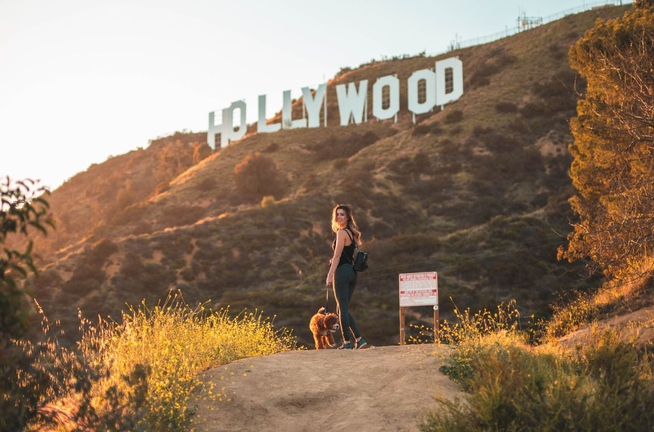
1. Runyon Canyon Park
Name and Location: Runyon Canyon Park is located in Hollywood off N Fuller Ave.
History and Significance: This off-leash dog park situated below the Hollywood Sign offers city views along its trails since 1984.
What to Expect: Hikers ascend about 200 feet along dirt trails to capture views of the Hollywood Sign and downtown skyline with possible celebrity sightings.
Visitor Information: Runyon Canyon loops are less than 3 miles. The park is open daily from sunrise to sunset.
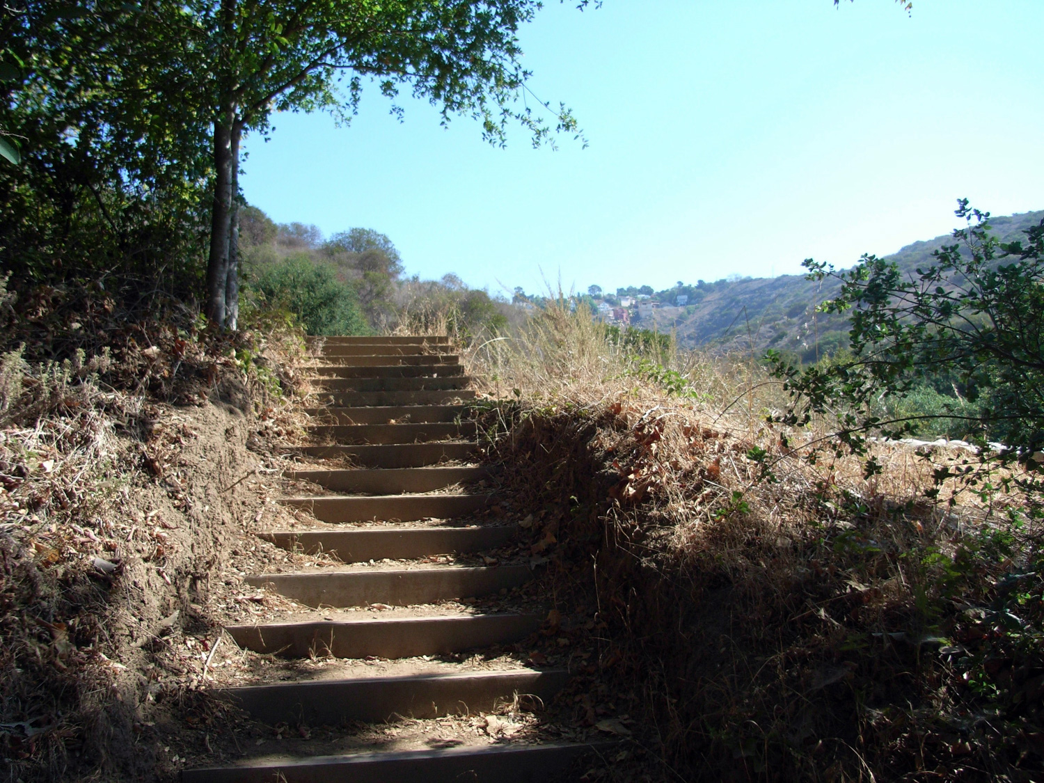
Runyon Canyon Park in Hollywood is one of the most popular hikes for both locals and visitors. The scenic 160-acre park is conveniently located in the heart of the city. There are several interconnected trails of varying distances and difficulties. The hike offers beautiful views of the Hollywood sign and downtown LA.
The most popular route is the 2.5 mile Main Trail Loop which gains about 500 feet in elevation. Starting from the Fuller Gate entrance, hikers are treated to city views as they wind up through Runyon Canyon. The trail ranges from wide dirt paths to rocky single-track. Benches are available for breaks along the way. Once completing the loop, you can add on the Inspiration Point Trail for even better views.
With its central location and panoramic views, Runyon Canyon is a must-do hike when visiting LA. Just be ready as parking fills up early most days.
2. Eaton Canyon Trail & Waterfalls
Name and Location: Eaton Canyon Trail & Waterfalls reach into the San Gabriel Mountains, with trailheads starting at 1750 N Altadena Dr.
History and Significance: This wildlife area features a popular hike to the 40-foot Eaton Falls with scenic pools below.
What to Expect: The 5-mile roundtrip crosses over creeks and rocky terrain leading to the waterfall base. Early hikes better spot cascading water.
Visitor Information: The nature center gate opens at 8 am when hikers can access Eaton Canyon to reach the falls.
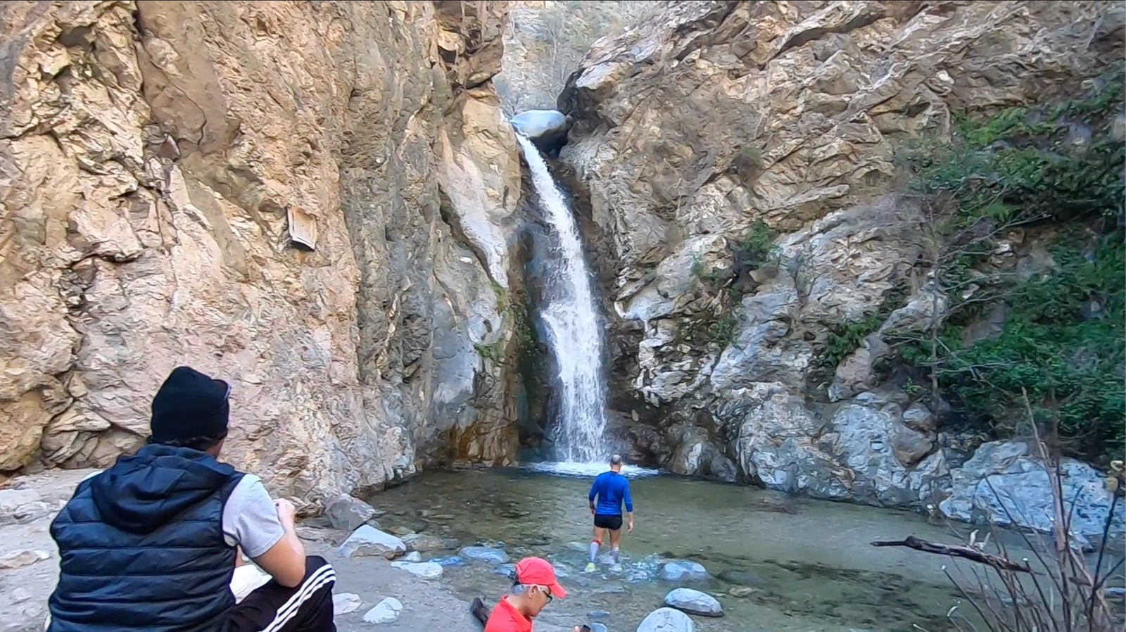
Nestled in the foothills of the San Gabriel Mountains, Eaton Canyon Natural Area has one of the most rewarding short hikes in LA. The easy 2.1 mile roundtrip hike leads to a beautiful waterfall flowing over a 40-foot cliff into a pool.
Starting at the nature center, follow the wide dirt trail upstream along the Eaton Creek wash. Cross over a bridge and continue along the canyon. There are benches and overlooks along the way to stop and take in the forested landscape. Once you arrive at the base of the waterfall, pools below provide a scenic spot for a rest or quick dip.
Beyond the waterfall, more advanced hikers can continue on the trail which connects to other routes in the San Gabriel Mountains. Arrive early on weekends when Eaton Canyon is very popular. Entry fees apply for parking.
3. Solstice Canyon Trail
Name and Location: Solstice Canyon Trail begins near Corral Canyon Rd. and runs through the Santa Monica Mountains.
History and Significance: The hike winds through the ruins of a century-old estate destroyed by wildfires to a scenic waterfall.
What to Expect: Hikers traverse 5.6 miles through the burned canyon landscape to the ruins and cascading falls framed by vegetation.
Visitor Information: Solstice Canyon Trail is open daily from 8 am to sunset as part of the Santa Monica Mountains National Recreation Area.
For ocean views, waterfalls, and rich history, hike the moderate 5 mile loop through Solstice Canyon in the Santa Monica Mountains. Starting on the wide Rising Sun Trail amid pepper trees and vineyards, you’ll immediately step back in time. The restored Roberts Ranch House stands as a glimpse into 1900s life in the canyon.
Continuing through lush woodlands and across streams, the trail connects to the Old Boney Trail delivering you to Tropical Terrace. The ruins of a glamorous resort damaged in wildfires still stand. Next is the highlight – a beautiful waterfall cascading down mossy rocks into a pool. End the loop on the Canyon Trail back to the ranch house.
With ocean views, interesting historic sights, and a scenic waterfall, Solstice Canyon Trail has something for everyone. Try for a peaceful hike midweek as weekends get busy.
4. Wisdom Tree & Cahuenga Peak Hike

Name and Location: Wisdom Tree & Cahuenga Peak Hike ascends from Cahuenga Blvd behind the Hollywood Sign.
History and Significance: The Wisdom Tree has endured since growing out of a charred trunk as a symbol of hope after fires swept Griffith Park in 2007.
What to Expect: Trekkers can view the Hollywood Sign up close, note the Wisdom Tree and ascend the Cahuenga Peak summit at the 2.7-mile mark.
Visitor Information: No permit is required to hike the trail open from sunrise to sunset daily. Parking is available near the trailhead.
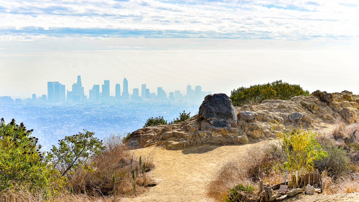
For city views without the crowds, tackle the moderately strenuous 3 mile out-and-back hike to Cahuenga Peak in Burbank. You’ll ascend 1,300 feet to the highest point in Griffith Park with panoramic vistas of LA and the iconic Hollywood Sign.
From the trailhead near the Griffith Observatory lot, follow the uphill path into the rugged hills. At the junction, opt for the East Trail to continue your ascent. Stop at the Wisdom Tree – a lone tree growing atop a hill that makes an iconic LA photo opp. From here, push on up the steep but scenic trail to Cahuenga Peak.
Rest on the rocky outcroppings and relish the hard-earned views of LA. Less crowded than the popular Griffith Observatory hike, this trail offers solitude and sweeping vistas. Descent is quick on the way back down.
5. Mishe Mokwa Loop Trail
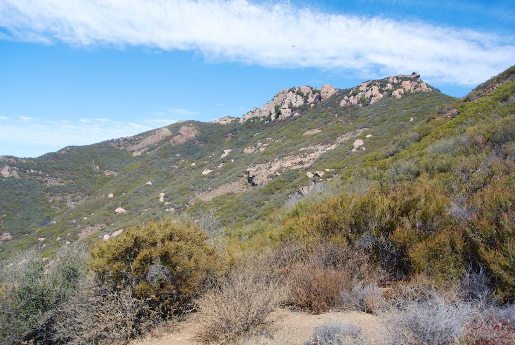
Name and Location: Mishe Mokwa Loop Trail traverses the Santa Monica Mountains starting at Split Rock Picnic Area near Encinal Canyon Rd.
History and Significance: Translating to “mother bear” in the Chumash language, this peaceful trail features lush scenery including oak glades and rocky streams along the route.
What to Expect: Hikers encircle picturesque sandstone boulders and the surrounding landscape over 6.4 miles with minimal changes in elevation.
Visitor Information: No fee or permit is required for day use of Mishe Mokwa, open daily in the recreation area from 8am until sunset.
Descend into the lush wilderness of Trippet Ranch on the scenic 6.5 mile Mishe Mokwa Loop in the Santa Monica Mountains. Featuring varied landscapes from wooded canyons to rocky ridges with ocean vistas, the loop is one of the best trails in the area.
From the ranch grounds, opt for the clockwise direction traversing Carlisle Canyon first on a tree-canopied dirt trail. At Split Rock, take the High Road for ocean views towards Point Mugu. After reconnecting with the Carlisle Canyon Trail, you’ll arrive beneath the dramatic sandstone formations of Skull Rock. Finish the loop winding through the peaceful oak groves of Sandstone Peak Trail.
With some steep sections, Mishe Mokwa Loop is a more challenging but incredibly scenic trail perfect for advanced day hikers.
6. Escondido Falls Trail
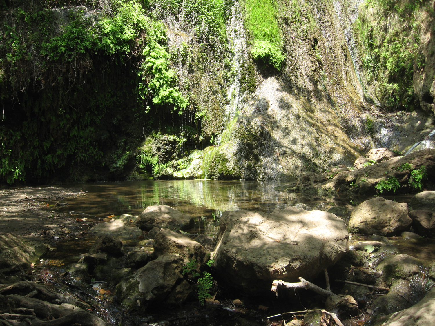
Name and Location: Escondido Falls Trail climbs off Winding Way in the Santa Monica Mountains to a 150-foot waterfall.
History and Significance: Fed by natural springs, these cascading falls pouring into pools below make for a popular, family-friendly hike in the region.
What to Expect: The 2.6-mile out-and-back route gains 500 feet in elevation on the way to the lush falls surrounded by vegetation and rock formations.
Visitor Information: No fees or permits needed. The trail is open daily from 8am to sunset as part of the surrounding recreation area.
At just over 3 miles roundtrip, the Escondido Falls Trail delivers big rewards, including a picturesque 150-foot waterfall, for little effort. Tucked high in the Santa Monica Mountains, the trail follows a shaded, peaceful creek before arriving at the cascading waterfall.
From the parking area, head downhill into the lush canyon following the sound of water. Boulder hop across the creek and wind your way under sycamore trees until you reach the powerful waterfall. Explore the base or carefully scramble up rocks bathed in mist for an up-close vantage point.
Photogenic year-round, Escondido Falls is an idyllic hike for nature lovers and waterfall chasers. Just prepare for limited parking.
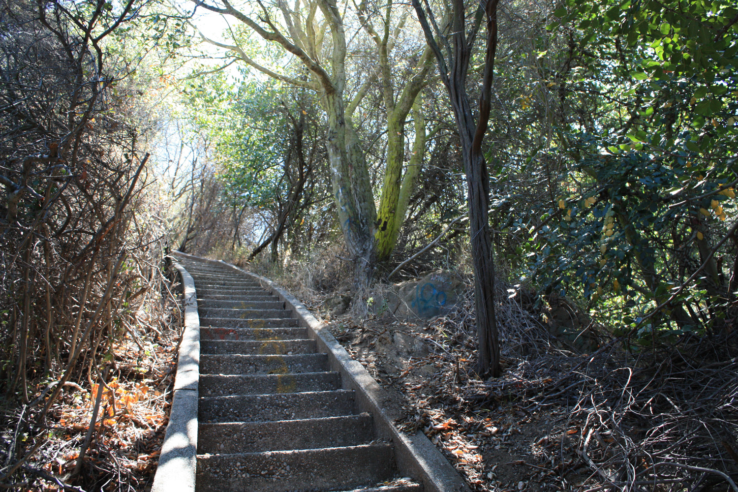
7. Bridge to Nowhere Hike
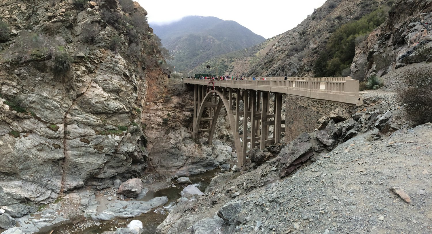
Name and Location: Bridge to Nowhere Hike leaves out of a parking lot at the end of East Fork Rd. near Azusa.
History and Significance: The trail gets its name from a bridge built in 1936 now standing isolated after floods washed away connecting roads.
What to Expect: After crossing the East Fork San Gabriel River, hikers end up at the towering bridge with scenic views of riverside ravines covered in graffiti.
Visitor Information: Access is allowed between 6am to 8pm. The nearly 10-mile round trip hike involves stream crossings.
Take an adventurous hike to a unique landmark on the popular Bridge to Nowhere Trail in the San Gabriel Mountains. Situated deep within the San Gabriel Wilderness, hikers walk 5 miles one-way to the impressive abandoned bridge in Sheep Canyon.
From the parking lot, follow the East Fork Trail gradually uphill through the forest. Crisscross the rocky streambed and pass by lush examples of native flora until you reach the dramatic bridge. Scramble down to explore underneath the arching concrete bridge standing tall with no roads connected.
Plan for an all-day 10 mile out-and-back hike along the scenic waterway to see this hidden ruin. While lengthy, the Bridge to Nowhere hike is a favorite LA adventure. Arrive early as parking is limited.
8. Mount Hollywood Trail
Name and Location: Mount Hollywood Trail summits Mount Hollywood behind Griffith Observatory in Griffith Park.
History and Significance: Culminating at almost 1,625 feet elevation, the Mount Hollywood summit serves up panoramic views across Los Angeles and the San Fernando Valley below.
What to Expect: Hikers traverse just over 3 miles gaining about 600 feet in elevation on the way to unmatched cityscape views with a glimpse of the backside of the Hollywood Sign.
Visitor Information: No hiking fee or permit required. The route stays open from 5 am to 10:30 pm daily.
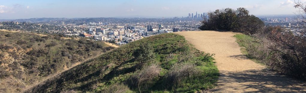
Summit Mount Hollywood for sweeping 360 degree views of Los Angeles and the surrounding area. Located in Griffith Park, the 5.7 mile roundtrip hike gains about 1,000 feet in elevation on the way to the 1,625 foot summit.
From Griffith Observatory, take the Charlie Turner Trail uphill into the landscape of chaparral-covered slopes. Traverse across the north face of Mount Hollywood to the peak. Standing atop the summit marker, relish the panoramic views from downtown LA to the Pacific Ocean.
A clear day is essential to take in the sights from one of the highest peaks in Griffith Park. Descend via the same route or connect to other park trails for a longer loop hike.
9. Murphy Ranch Trail
Name and Location: Murphy Ranch Trail starts up Sullivan Ridge Fire Road off Capri Dr. in Pacific Palisades.
History and Significance: The site was developed in the 1930s by Nazi sympathizers before authorities raided the complex during WWII, leaving ruins explored today.
What to Expect: Hikers encounter concrete foundations of the former ranch punctuating the 3.3-mile loop which climbs over 500 feet elevation before descending.
Visitor Information: No fee to visit. Leashed dogs allowed. The trail closes at sunset as part of Topanga State Park.
History and scenery blend together on the Murphy Ranch Trail in Topanga State Park. Hike down to abandoned Nazi ruins on this 3.6 mile loop that incorporates the Mesa Peak Trail for ocean views.
From the trailhead off Capri Road, descend into the canyon following the wide fire road. Concrete foundations and stairs appear as you enter the eerie grounds that once held the communal living quarters of a Nazi sympathizer camp during WWII. Scramble through the ruins before taking the Back Trail up to Mesa Peak and returning on the Mesa Peak Trail.
Beyond the intriguing historical aspect, you’ll also enjoy coastal panoramas from the rugged cliffs of Mesa Peak on this hike.
10. Stunt High Trail to Saddle Peak
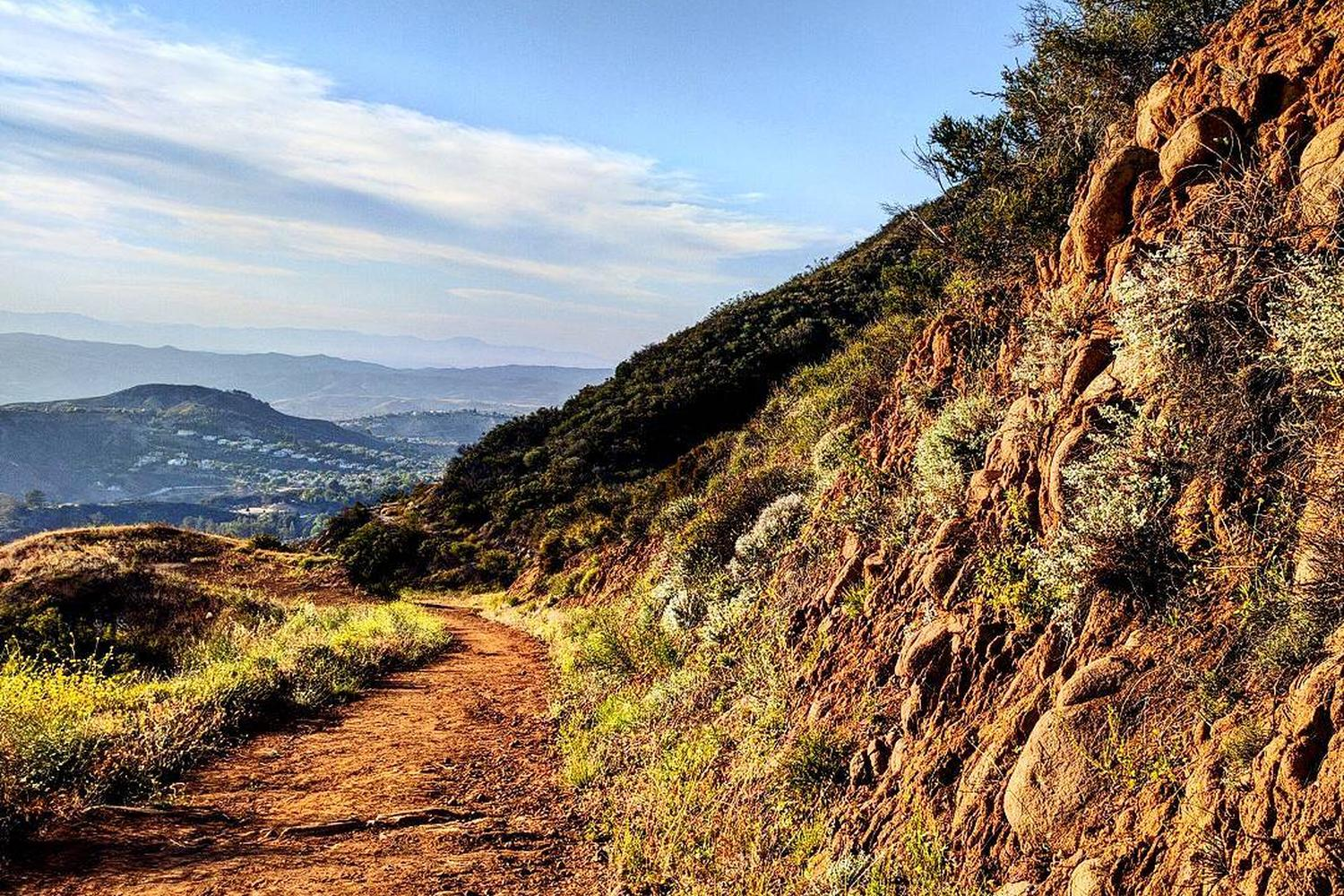
Name and Location: Stunt High Trail to Saddle Peak begins at Stunt Rd. in the Santa Monica Mountains.
History and Significance: Winding 2.5 miles to the highest point in the area at just over 1,700 feet, the hike culminates at an old Nike missile site with sweeping views.
What to Expect: Hikers scrambled over boulders and technical terrain before reaching panoramic vistas to Catalina Island and beyond from the top of Saddle Peak.
Visitor Information: No fee required. The trail crosses through Malibu Creek State Park to the summit open 8am to sunset.
For big ocean views and challenging terrain, hike the 8 mile loop to Saddle Peak in Malibu. A rigorous but rewarding trail, you’ll ascend over 1,500 feet above the Pacific Coast.
Starting at Stunt Road, the first stretch up Stunt High Trail delivers ocean and island views throughout the chaparral-blanketed slopes. After joining the Saddle Peak Trail, continue uphill to the tallest summit in the area. Enjoy unmatched coastal vistas before looping back via Schueren Road.
Be prepared for steep drop offs along the narrow ridge trail to Saddle Peak. Stunt High Trail is one of the most scenic coastal hikes in LA.
11. Los Liones Trail to Parker Mesa Overlook
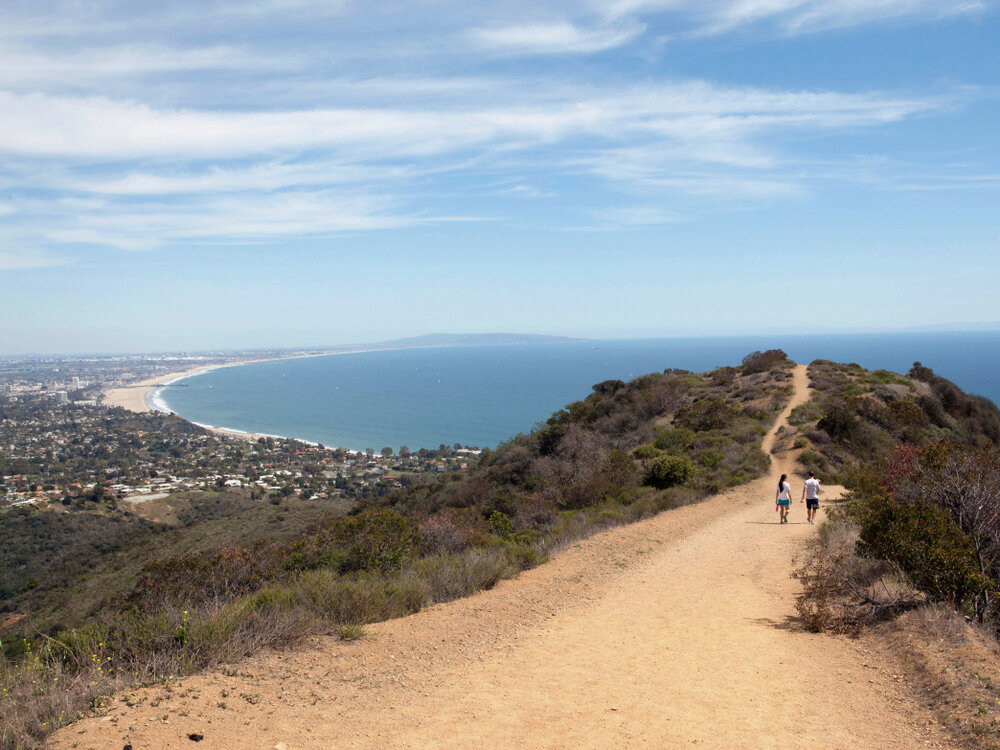
Name and Location: Los Liones Trail to Parker Mesa Overlook traverses Pacific Palisades up Los Liones Dr.
History and Significance: Translating to “the lions” after lion statues formerly guarding the trailhead, this path climbs through chaparral to wide vistas including Catalina Island offshore.
What to Expect: Hikers ascend over 500 feet across 2.6 miles to lookout points over the Santa Monica Mountains, city and ocean beyond. The trail loops back down for almost 5 miles total.
Visitor Information: No fee required to access the route open daily 8am until sunset as part of Topanga State Park.
Explore the Pacific Palisades on the moderate 2.6 mile roundtrip hike to Parker Mesa Overlook. Located within Topanga State Park, the trail rewards hikers with sweeping ocean views from the coastal bluffs.
Starting at the trailhead at Los Liones Drive, take the fire road uphill through chaparral with peekaboo ocean views. At the marker for the Parker Mesa Overlook Trail, opt for the steep singletrack path to ascend directly to the clifftop overlook.
Take in the exceptional vistas over Santa Monica Bay from the Parker Mesa clifftops. Return via the same route or extend into a longer loop hike through the surrounding mountain trails.
12. Zuma Canyon Trail to Zuma Falls
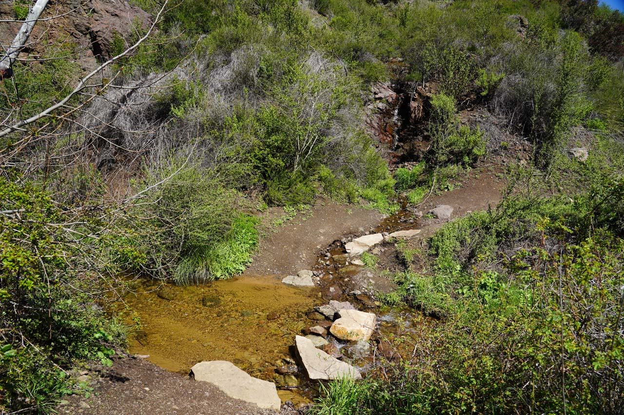
Name and Location: Zuma Canyon Trail to Zuma Falls starts from Busch Dr. outside Malibu.
History and Significance: Fed by natural springs, these cascading falls pouring into pools below make for a popular, family-friendly hike in the region.
What to Expect: The 5.4-mile loop rolls along Zuma Creek under sycamore trees to a scenic waterfall tucked below Zuma Ridge at the canyon’s end.
Visitor Information: Access Zuma Canyon in the Santa Monica Mountains NRA for free from 8am-sunset daily. Parking fills early on weekends.
One of the most rewarding day hikes in Malibu, the moderate 6 mile roundtrip Zuma Canyon Trail culminates at a scenic waterfall and swimming hole. Following a shaded creek through a narrow canyon, hikers are treated to tranquil swimming holes and oak/sycamore groves before reaching the 30-foot waterfall.
From Zuma Canyon Road, head downhill on the partially paved trail into the canyon. Pass through the split-rail fences marking crossings between public land and private property until you reach Upper Zuma Falls. Continue further to arrive at the larger Lower Zuma Falls – an idyllic spot to rest and refuel before the return hike uphill.
Featuring epic ocean views, rugged mountains, desert terrain, and urban forests, the best hiking trails in Los Angeles offer unlimited outdoor adventures. With this list of scenic trails, you’re ready to lace up your boots and hit the diverse landscapes surrounding LA.


Join the Conversation