
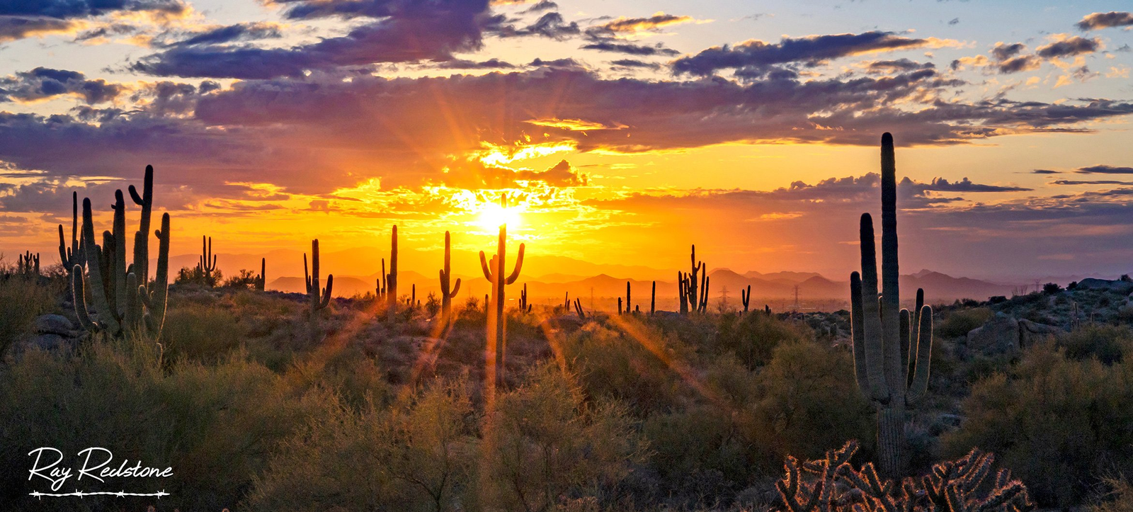
Blessed by nearly 300 days of annual sunshine, Mesa delivers hiking opportunities as limitless as desert skies overhead. The city rests in the Sonoran Desert surrounded by rolling peaks, ridgelines and lush riparian areas crisscrossed by trails satisfying every skillset. From family-friendly interpretive loops to steep summit climbs granting panoramic views, Mesa serves as an ideal launch point for hiking adventures.
| Trail Name | Description | Length & Elevation Gain | Unique Features |
|---|---|---|---|
| Superstition Ridgelines | Panoramic views of Four Peaks and Superstition Mountains | 1.2 miles, 500 feet elevation gain | Apache Leap, wildflower bursts |
| Hieroglyphic Trail | Ancient petroglyphs by the Hohokam culture | Half-mile loop, relatively flat | Rock art etchings, historic significance |
| Usery Mountain Peak | Summit hike with views in all directions | 3.4 miles, 1,600 feet elevation gain | Challenging terrain, iconic summit |
| McDowell Sonoran Preserve | Stroll through mesquite groves | North Trail: 6.4 miles, South Trail: 5.7 miles | Rare riparian habitat, wildlife |
| Browns Ranch Trailhead | Views of Four Peaks | 5 miles, relatively flat | Photography opportunities, family-friendly |
| Flatiron Trail | Superstition Mountain vistas | 1.2 miles, 550 feet elevation gain | Easy access, quick summit |
| Pemberton Trail | Wildflowers and cacti displays | 4.2 miles, moderate difficulty | Seasonal floral displays, wildlife |
| Pass Mountain Trail | Panoramic views from Usery Mountain | 7.4 miles, 1,500 feet elevation gain | Comprehensive vistas, varied terrain |
| Holbert Trail | Mini Grand Canyon views | 3.5 miles, 800 feet elevation drop | Dramatic landscapes, historical significance |
| Hawes Loop Trail | Wildflower photography | 3.5 miles, easy difficulty | Seasonal wildflower blooms, scenic views |
| Mormon Trail | Petroglyph sightings | 6 miles point-to-point, moderate difficulty | Historical significance, indigenous art |
This article details 12 of the most scenic, historic and iconic trails for lacing up your boots across Mesa’s striking natural landscapes. Follow cactus-dotted paths to prehistoric native sites, through wildflower meadows and up gnarled peaks named for early Arizona legends. Each route provides epic yet accessible desert immersion only steps beyond Mesa’s suburbs.
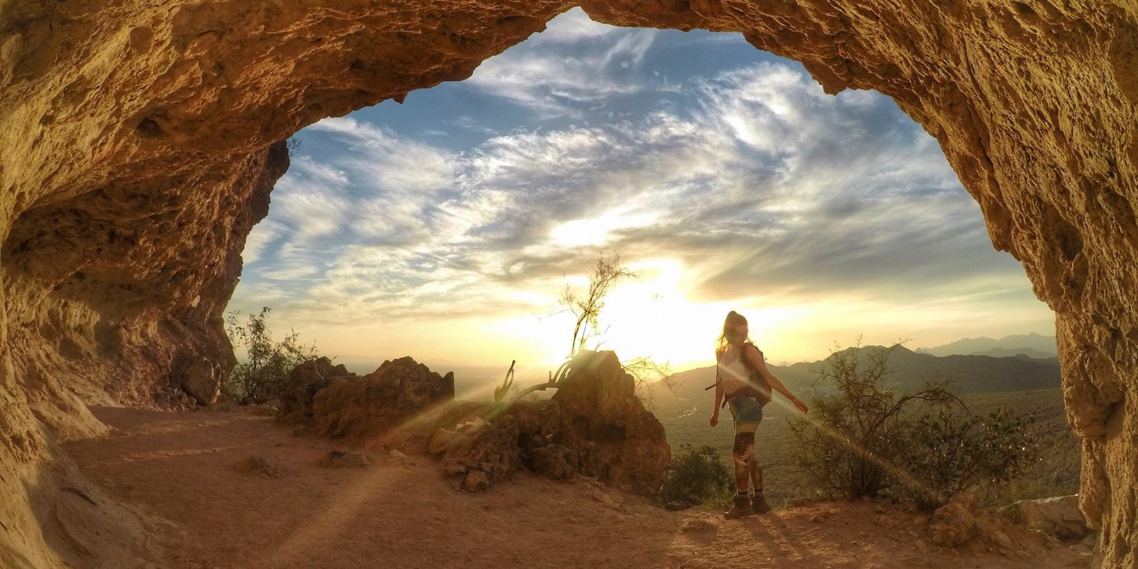
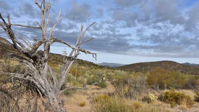
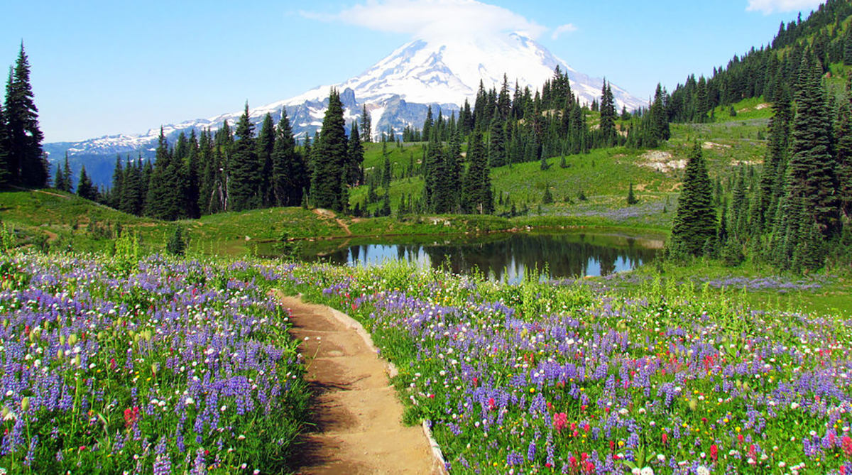
Hike Majestic Superstition Ridgelines
Name and Location: Hiking Superstition Ridgelines offers breathtaking views amid rugged Superstition Mountains terrain just east of Apache Junction and Mesa, Arizona.
History and Significance: Ridges atop central Arizona’s Superstition massif afford panoramic Sonoran Desert perspectives across mountain vista landmarks visible only on foot, including where the reputed Lost Dutchman’s gold mine may lie hidden.
What to Expect: Expect strenuous climbs bellying unforgettable vantage points over surrounding ranges, canyons, and valleys via booted or NPS-guided hikes ranging from moderate day trips to multi-day 600-foot elevation gains following precipitous exposed climbs and steep descents.
Visitor Information: Year-round access. Some permit fees may apply for overnight trips. Prepare for remote conditions lacking water sources or emergency services. Appropriate hiking gear required. Guided options available.
For superb panoramas of iconic Four Peaks and craggy Superstition Mountains jutting abruptly from desert plains, the hike to Apache Leap rewards with nonstop beauty. Starting from US 60’s Apache Trail pullout near Lost Dutchman State Park, the moderate trail navigates through spring wildflower bursts up to a saddle along the imposing ridgeline defining Tonto National Forest’s western edge.
Over just 1.2 miles reaching the lookout, the route gains 500 feet in elevation yielding big scenic payoffs for moderate effort. Retrace steps or connect into other Superstition trails for lengthier adventures like trekking to the curious rock spire named Table Top Mountain watching over flatlands dropping far below its cliffs.
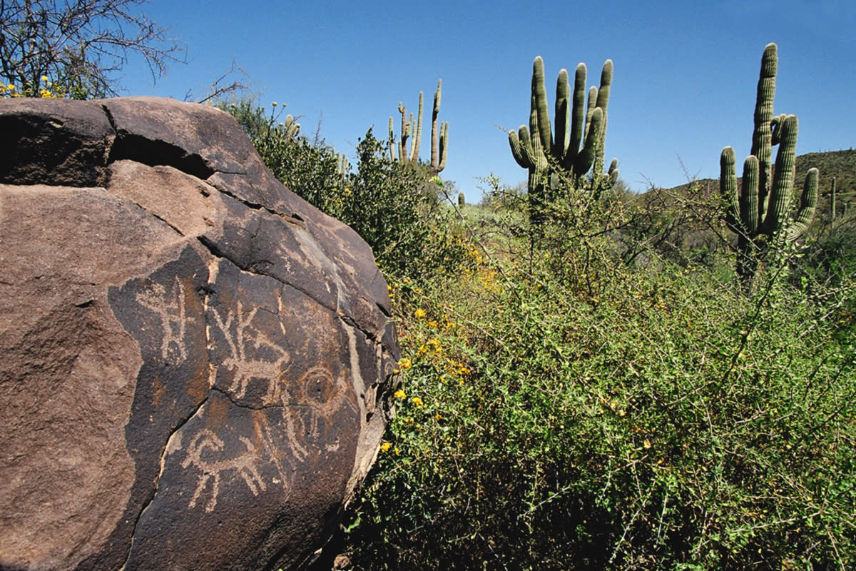
See Ancient Petroglyphs at Hieroglyphic Trail
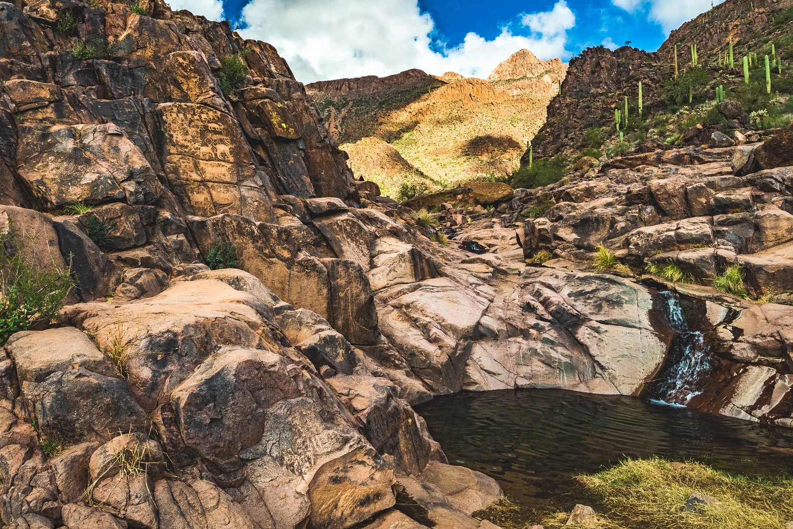
Name and Location: Hieroglyphic Trail located within the Superstition Wilderness showcases remarkable American Indian rock art finds approximately 30 miles east of Mesa off Hwy 60.
History and Significance: First discovered by 19th century gold miners, preserved basalt boulders with estimated 600-year-old etchings representing spirals, human figures, animals and shapes compose one of the country’s densest figurative petroglyph art galleries.
What to Expect: Locate designated petroglyph clusters by following cairns from the trailhead to appreciate and photograph distinctive archaic etchings. Their locations and meanings remain shrouded in intrigue and speculation. Stay on paths to prevent damage.
Visitor Information: Moderate out-and-back hiking required. Prepare for warm, exposed conditions. Accessible year-round. Permit and fees may apply. Recreate responsibly to ensure preservation of fragile cultural artifacts.
Step back through centuries to stand beside rock art etchings crafted by the Hohokam culture occupying Mesa over one thousand years ago at Gold Canyon’s hieroglyphics site. Located just past the popular guided tours into underground tunnel cave systems hand-carved by ancient peoples here to escape extreme desert heat, the short-and-sweet Hieroglyphic Trail loop remains relatively flat.
Yet its half-mile path still transports hikers witnessing intricate human and animal shapes chiseled into dark patinaed boulders — early Mesa inhabitants’ messages sent to us through time even archeologists cannot fully translate. Mindfully walk the loop gazing upon echos of past lives with the same desert vistas surrounding their makers.
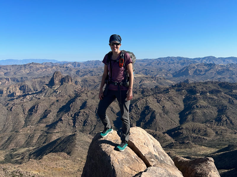
Summit Usery Mountain Peak
Name and Location: The Usery Mountain summit near Mesa overlooks the Goldfield Mountains across vast Tonto National Forest landscapes with panoramic Superstition views.
History and Significance: Named after a local ranching family, Usery peaks form the centerpiece of a larger regional park system. From its highest point, surrounding mountains, saguaro stands and city views create a scenic desert backdrop accessible by foot following switchbacking trails.
What to Expect: Hikers ascend over 1,300 feet across moderate grades to see spreads of Phoenix Valley cities, landmarks like Four Peaks, diverse vegetations, and desert basin features unfolding atop an iconic regional backdrop.
Visitor Information: Open year-round. User fee applies (free on Wednesdays). Restrooms at trailhead. Come prepared with proper hiking attire, water and precautions.
While the entire surrounding Usery Mountain Regional Park claims over 29 miles of hiking across dramatically eroded terrain, summiting its centerpiece namesake mountain makes for Mesa’s iconic must-do hike. Trails crossing Usery Pass deliver over 1,600 feet of elevation spanning 3.4 miles to earn staggering views in all directions.
The most efficient route charges straight up the falls countering Usery’s north face. Feel your heartbeat match your footfalls scrambling over loose rocks and boulders on the aptly-named brutal yet relatively quick Summit Trail. Celebrate surmounting the highest peak among Usery’s ridgelines by admiring endless vistas. On super-clear days even glimpse slivers of Mexico beyond reaches of cactus carpeting crests surrounding this desert oasis!
Stroll Scenic Mesquite Groves in McDowell Sonoran Preserve
Name and Location: Located minutes outside Scottsdale, the McDowell Sonoran Preserve encompasses wide swaths of unique Sonoran Desert landscape including mesquite forests open for public recreation off Bell Road.
History and Significance: Saved from development threats in the 1990s, mesquite bosques now afford shady, intimate walks past gnarled multi-branch canopies sheltering diverse cacti, wildflowers, birdlife and small wildlife native to precious watershed lands within one of America’s largest urban preserves at over 30,500 acres.
What to Expect: Flat, easy trails wander through scenic groves shrouding surprise oases, native cultural sites, lush micro-environments and rocky formations hidden amid signature desert terrain – each turn unfolding natural wonders on intimate terms.
Visitor Information: Year-round preserve access. Some fees may apply. Visitor center at Gateway Trailhead. Leashed dogs permitted. Pack light layers, ample water and trail etiquette essential.
Cooling cottonwoods and mesquite thrive along riparian corridors nurtured by scarce Sonoran streams, creating rare oases ribboning through harsher cactus-spotted desert. At McDowell Sonoran Preserve bridging Scottsdale and Mesa, two routes snake through rare, precious mesquite groves whose dappled shade shelters abundant wildlife.
Starting from Lost Dog Wash Trailhead near Bartlett Lake’s grassy picnic spots, the North Trail’s 6.4-mile loop and South Trail’s 5.7-mile path overlap for a one-mile scenic stretch perfect for short family treks. Linger watching for jackrabbits, quail and lizards darting amid knee-high wildflower carpets in spring when temperatures stay mild before summer’s triple digits hit.
Photograph Four Peaks Along Browns Ranch Trailhead
Name and Location: The Browns Ranch Trailhead within Mesa’s McDowell Mountain Regional Park connects hikers to the park’s remote western edge for striking Four Peaks panoramas deep amid cactus forests and rock formations.
History and Significance: Named for early 20th century cattle ranchers, the area’s stunning natural scenery foregrounding the storied Four Peaks has long held allure for indigenous peoples, pioneers, cattlemen and desert rats drawn by its remote location and inspiring vistas that stir an irrestible, enduring bond.
What to Expect: Moderate to challenging trails give way to rugged isolation amid untamed desert where Four Peak’s angular ridgelines lord over saguaro-dotted basins, slot canyons and stagecoach routes – a raw frontier ideal for photography and reflection.
Visitor Information: Year-round access. Permit/fees required. Long sleeves/pants advised for vegetation protection. Prepare for encounters with wildlife, intense sun and lack of cell service in extremely remote conditions.
Whether glimpsing Four Peaks’ distinctive saddle-like summits from Mesa suburbs or up-close while summiting, the Sierra Ancha’s highest point remains an unmistakable orientation point for locating north. Near the tiny Tonto Basin hamlet, Browns Ranch Trailhead by Roosevelt Lake furnishes optimal angles to admire Four Peaks’ majestic character.
The relatively flat 5-mile out-and-back path entices families and photographers alike with plenty of photo ops, including overlooking the vivid turquoise bay beside Chollaboat Beach. Arrive at sunrise or sunset when Four Peak’s craggy north face ignites brilliant orange to echo the desert skies – just mind occasional crowds also flocking here for the phenomenal fiery views!
See Panoramic Superstition Vistas from Flatiron Trail

Name and Location: The Flatiron Trail ascends through Lower La Barge Box Canyon within the heart of the Superstition Wilderness Area approximately 35 miles east of Mesa off Hwy 60 near Apache Junction to stunning Superstition Mountain overlooks.
History and Significance: Skirting towering rock formations and crossing a water-carved gorge thick with saguaro stands, the area’s natural scenic wonder has made it an enduring landmark for native inhabitants, prospectors, ranchers and modern desert goers relishing the commanding, spiritually moving landscape from Flatiron’s pinnacle.
What to Expect: A strenuous 5-mile climb over steep, uneven grades is rewarded with a perfect panorama featuring Weaver’s Needle, Battleship Mountain and Four Peaks unfolding across the wilderness in an unforgettable portrait of the Sonoran’s beauty and allure.
Visitor Information: Permit required. Year-round access but summer heat hazards. Prepare for lack of water and extreme solitude. Utmost Leave No Trace ethics mandatory.
While the Superstition Mountains host hundreds of miles of challenging trails, the easy, short yet steep Flatiron Trail ascending a small ridgeline neighboring Lost Dutchman State Park makes summiting attainable for most hikers craving big views fast. Along this 1.2-mile route and only 550 feet of elevation gain, tempting glimpses of the Superstitions’ weathered rock citadels keep you motivated onwards and upwards.
Once surmounting the flattened apex of “Flat Top” hill, spin 360-degrees from rusty slab boulders taking in the entirety of thickly-forested ridgelines defining Arizona’s fifth-largest designated wilderness area that sprawls across a whopping 271,400 acres! After catching your breath, retrace downhill to the Siphon Draw Trailhead with grand memories looking over Arizona’s Wild West wonderlands.
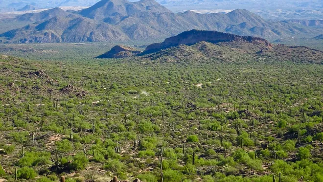
See Spring Cactus Blooms Along Pemberton Trail

Name and Location: Winding through stands of mature saguaros and bountiful spring wildflowers in the McDowell Sonoran Preserve north of Scottsdale, AZ, the Pemberton Trail delivers front-row seasonal floral displays.
History and Significance: Saved from development in the 1990s, fragile desert terrain within one of America’s largest urban preserves reveals annual floral pageantry drawing photographers, families and ecology buffs spying colorful blooms against endless rugged mountain skylines through early summer.
What to Expect: Easy, shaded trails skirt monumental saguaros with their yearly creamy white crowns plus dazzling desert ground displays to stir awe for the surprising bounty sustained across vulnerable yet resilient landscapes.
Visitor Information: Access year-round with peak visitation February-April. Permit purchase required. Visitors must tread lightly and walk only on marked trails to respect the delicate desert environment.
Joining the extensive McDowell Sonoran Preserve’s network of desert trails, the moderate 4.2-mile Pemberton Trail passing small mountains rewards hikers with plentiful wildflowers and cacti after sufficient winter rains. Starting from competitive cyclist hub Pemberton Trailhead, expect relatively even terrain with some rocky wash crossings and short ups-and-downs through typical Sonoran landscapes.
But the floral displays transforming brittlebush, hedgehog cacti, lupine, poppies and more into vibrant patches appear – especially late February through March – prove utterly remarkable. With connectivity to adjoining paths, avid hikers can continue roaming beyond scenic zones designated as habitat conservancies for native wildlife to witness nature’s desert bounty in all its glory.
Summit Pass Mountain Trail’s Super Views
Name and Location: The Pass Mountain Trail within Mesa’s Usery Mountain Regional Park climbs through desert wilderness to a flattened mountain peak apex with vast Superstition Mountain views.
History and Significance: Saved from private acquisition and named for a local ranching family, Pass Mountain since 1984 has been the centerpiece of a beloved regional park system with its lofty perch topping panoramic Sonoran Desert scenes as a favorite crown jewel summit destination.
What to Expect: Moderate switchback grades challenge hikers with heart-pumping elevation gains rewarded by an unencumbered 360° desert overlook. On crystalline days even saguaro farms beyond Apache Junction materialize along the spectacular horizon.
Visitor Information: Open year-round. Park use fee applies. Prepare for exposure. Restrooms at the trailhead. Utmost sun/heat precautions essential.
While most routes within Usery Mountain Regional Park offer gorgeous scenery across 3,600 acres, none compete with the 7.4-mile Pass Mountain Trail’s nonstop panoramas available in all directions. Extending from northern Usery Pass to southern trailhead by Merkle Trailhead, this path navigates valleys between prominent peaks delivering stunning vistas.
The path navigates through desert terrain gradually gaining 1,500 feet in elevation with moderate inclines. Once atop Usery Pass saddle point, be awed by the Superstition Mountains with Four Peaks beyond. Turn southward to admire the Santan Mountains’ ridgelines plus glimpses of downtown Mesa in the distance. For enduring vistas made epic by traversing Usery’s rugged ranges in between, the Pass Mountain trail proves a crown jewel.
See Mini Grand Canyon Along Holbert Trail
Name and Location: Holbert Trail near Usery Mountain summit overlooks the so-called “Mini Grand Canyon,” a desert sanctuary of erosion-carved cliffs, slot canyons, and a perennial waterfall deep within brown foothills terrain northeast of Mesa.
History and Significance: Still pristine and raw as originally revealed to settlers, elliptical bowls split by a sheer gorge create a remote desert haven. The challenging hike has long held intrigue for native peoples, explorers, desert ecologists and modern hikers reveling in its natural complexity.
What to Expect: Uneven paths descend steep grades into a sudden pocket paradise traversed by sandy washes through surprisingly lush micro-environments nourished by permanent water amid sheer, hardscrabble cliffs and Terry Flat’s sprawling uplands.
Visitor Information: Permit and fees required. Year-round access. Prepare for steep descent/ascent, hot sun and lack of services in an extremely remote area. Tread lightly.
While Arizona’s breathtaking actual Grand Canyon needs no introduction, Mesa hides its own smaller-scale canyon cutting dramatically through Usery Pass equally stunning to experience. Starting high from Usery Park’s Wind Cave Trailhead, the 3.5-mile Holbert Trail steeply descends over 800 feet into narrow switchbacks hinting at views awaiting below.
Suddenly the path opens upon sheer sculpted cliffs revealing the aptly named Little Granite Mountain glittering ocher and bronze like classically-carved canyonlands in afternoon light. Feel insignificantly tiny amid the soaring ravines and mighty Superstitions commanding the horizon for timeless perspective only such forcefully beautiful desert places furnish.
Photograph Wildflowers on Hawes Loop Trail
Name and Location: Winding along the base of Camelback Mountain in north Scottsdale, the Hawes Loop Trail treats hikers to serene Sonoran Desert scenery punctuated by spring wildflower displays.
History and Significance: Saved from development by preservation efforts in the 1990s, the fragile landscape protected within one of America’s largest urban preserves reveals itself slowly through the seasons – especially when brief floral blooms color its endless rugged contours from February into March.
What to Expect: Easy desert paths littered with desert jewels like orange globe mallow and purple lupine blooms skirting teddy bear cholla and mature saguaros with views opening up toward towering Camelback Mountain as a picturesque backdrop during peak wildflower outings.
Visitor Information: Year-round access. Permit purchase required. Visitors must tread lightly and walk only on marked trails to respect the delicate setting.
When winter rains drench desert soils, dormant seeds spring vibrantly to life across Mesa’s McDowell Sonoran Preserve blanketing the terrain in colorful floral trophies. The popular Hawes Loop Trail near Four Peaks trailhead furnishes nearly panoramic views of wildflowers decorating creosote flats and cacti exploding yellow blooms for photographing native biodiversity at its finest.
This 3.5-mile easy, family-friendly hiking circuit traverses gently rolling hills mingling teddy bear cholla, prickly pear, desert marigold and Mexican poppy with ocotillo, yellow palo verde trees and sagebrush throughout the spring season. For shutterbugs and leisure trekkers seeking flora fix, Hawes’ sweeping scenery dotted in delicate wildflowers portrays stunning tableaus epitomizing Arizona’s most spectacular seasonal phenomenon.
Spot Petroglyphs Along Mormon Trail
Name and Location: Petroglyphs etched into stone outcroppings appear sporadically off the Mormon Trail located within the Superstition Wilderness Area outside Apache Junction if observers explore quietly and look closely enough.
History and Significance: Evidence of archaic peoples etched for reasons still mysterious, sporadic petroglyph markings – including human and animal forms – materialize intermittently upon the rocky terrain, ensuring fascination endures for descendants and respectful passersby seeking transient desert insights.
What to Expect: Look for signs off trailsides pointing toward individual rock art panels. Tread extremely lightly and avoid contact to preserve their integrity. Photograph find locations only, or simply pause to appreciate their mystique fully in silence.
Visitor Information: Accessible year-round to prepared hikers. Permit required. Remote conditions. Pack only essentials for safety. Ensure utmost preservation ethics toward potentially unmarked cultural sites.
Before Mormon pioneers wagon-trained from Utah to settle what became downtown Mesa in the late 1800s,native peoples traversed these same desert lands for ages leaving traces still visible today along hieroglyphic trails. Two petroglyph sites containing Hohokam artifacts exist near Usery Pass reachable via connecting Mormon and Carpet trails stretching over six miles point-to point.
From the trail, keen observers can spot individual carvings left by indigenous tribes depicting animals like big horn sheep beside human forms – early rock art GPS mapping resource locations for later return visits. While not Mesa’s only petroglyphs, the ancient etchings encountered along this path resonate thanks connecting past travelers who navigated similar routes eons ago.
Conclusion
From cactus-dotted desert panoramas to early native archaeological sites conveying Mesa’s first settlers thousands of years in the past, hiking trails across this vibrant Sonoran city tell rich stories. Climb ridgelines revealing Superstition Mountain vistas that seem to stretch into eternity. Wander through rare riparian stream corridors sheltering cottonwood groves and abundant wildlife. Scramble peaks named for prospectors like Jacob Waltz who perpetuated fables of lost gold mine troves lurking somewhere deep within shadowy canyons bellow. Whatever epic adventure entices your exploratory soul, Mesa brings myriad trails letting boots meet the dusty earth crossing paths with yesterday and tomorrow simultaneously.


Join the Conversation