From the iconic Boston Common to emerald gems like the Arnold Arboretum, Boston and surrounding areas boast some of the best city parks in the country. Many offer seasonal foliage and blooms, miles of tree-lined trails, intriguing history and plenty of spots to picnic, play and simply relax amid nature without leaving the city.
| Park Name | Key Features |
|---|---|
| Boston Common | Historic park, events. |
| Public Garden | Botanical, sculptures. |
| Charles River Esplanade | Waterfront, activities. |
| Franklin Park | Zoo, golf course. |
| Christopher Columbus Park | Harbor views, playground. |
| The Arnold Arboretum | Plant collections, trails. |
| Jamaica Pond | Boating, fishing. |
| Rose Kennedy Greenway | Gardens, art installations. |
| Boston Harbor Islands | Camping, historic sites. |
| East Boston Greenway | Bike paths, community gardens. |
| Southwest Corridor Park | Walking paths, tennis courts. |
| Olmsted Park | Waterways, green spaces. |
The following are 12 of the top picks across Boston parks to enjoy fresh air whether you’re a local or visitor. The list spans famous staples downtown to riverfront hiking just outside the city and more, covering an array of landscapes from forest to coastal beaches perfect for any outdoor interest.
Boston Common
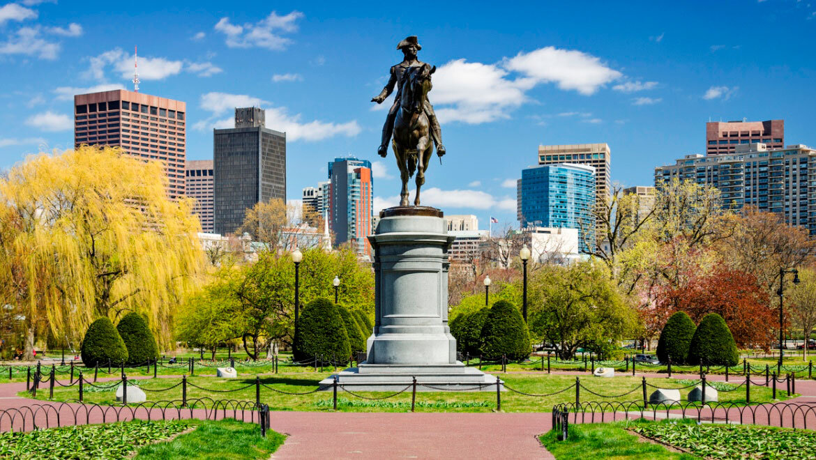
Name and Location: Boston Common is a 50-acre public park located along Tremont Street in downtown Boston, bound by Beacon, Park and Boylston Streets with Park Street T station nearby.
History and Significance: Established in 1634 as America’s first public park, the Boston Common has been an important recreation space for residents for over 300 years as well as the site of historic moments like early protests and Red Sox championship rallies.
What to Expect: Visitors can take a walk, relax under shade trees, let kids play at the Tadpole Playground, grab a snack, check out the ballpark field, public gardens, or just enjoy this iconic green space in the heart of the city.
Visitor Information: Boston Common stays open daily from dawn until 11PM. Public restrooms, metered street parking, and nearby MBTA stations available to access the area.
As the oldest city park in the country, leafy Boston Common packs loads of history within its Central Park-style layout covering almost 50 acres downtown. Its public benches and walking paths made it an important gathering space for 19th century protests and speeches by historical figures like Martin Luther King Jr.
Today people congregate for summer concerts or winter ice skating on the Frog Pond. Don’t miss exploring the adjoining Public Garden’s lagoon and bridge too – the icon of countless photos.
Arnold Arboretum
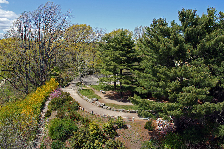
Name and Location: The Arnold Arboretum is a 265-acre botanical park located in Boston’s Jamaica Plain and Roslindale neighborhoods, managed by Harvard University.
History and Significance: Established in 1872 following landscaping plans of Fredrick Law Olmsted, the Arnold Arboretum serves as an important “outdoor museum” of over 15,000 trees, shrubs, and plants that supports conservation, research and education.
What to Expect: Visitors explore a mix of gardens, meadows, wetlands full of diverse botanical collections via miles of walking trails and roadways winding through this beloved greenspace. Seasonal highlights like lilac blooms and autumn leaves.
Visitor Information: The arboretum is open daily, dawn to dusk. Free guided tours offered seasonally. Parking available but limited on nicer days. Forest Hills MBTA stop provides closest transit access.
Managed by Harvard University, the Arnold Arboretum should top the list for green space lovers with its 281 acres of global trees and flowering shrubs. Follow over 14 miles of footpaths past collections like towering conifers, cherry tree allees and bonsai plantings for year-round intrigue – peak fall foliage is a standout.
Pack a picnic or browse the teahouse and visitors center too while soaking up air perfumed by over 15,000 specimens from around the world.
Franklin Park

Name and Location: Franklin Park, named for founding father Benjamin Franklin, sprawls over 500 acres in Boston’s Jamaica Plain and Roxbury neighborhoods with public entrances off Circuit Dr, Walnut Ave and Seaver St.
History and Significance: Franklin Park began development in the 1880s as Boston’s largest park and the “crown jewel” of Emerald Necklace designer Frederick Law Olmsted’s integrated green space trail circling Boston to promote public access and interaction with nature across various managed landscapes.
What to Expect: Visitors today enjoy greenhouses, playscapes, picnic groves, hiking trails from reservoirs to woodlands plus a zoo, golf course and schools occupying sections of Olmstead’s pastoral canvas integrating pastoral beauty benefiting all.
Visitor Information: Open daily with standard city park hours. Parkways access parking zones. Nearby stops on the Orange Line provide transit access. Recreational amenities vary across park sections.
At 527 acres, Franklin Park provides ample room for Bostonians to soak up sunshine for free through activities like golf, tennis and playground sessions. But its most beloved feature is the seven-mile Emerald Necklace loop trail for walking or biking amid diverse foliage and wildlife within America’s first public arboretum.
Don’t miss the park’s zoo and nature center for even more family fun from lemur greetings to hands-on discovery rooms too.
Christopher Columbus Waterfront Park
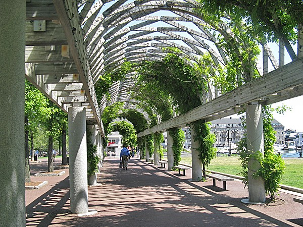
Name and Location: Christopher Columbus Park sits on Atlantic Avenue along Boston Harbor across from Long Wharf and next to the North End neighborhood.
History and Significance: Established in 1976 to commemorate Boston’s maritime history, this modern park commemorates explorer Columbus with overlooks, monuments plus the iconic Rose Kennedy Rose Garden honouring the Kennedy matriarch’s civic contributions.
What to Expect: Visitors admire harbor views along walkways and from benches circling fountains while also watching North Enders using the bocce ball court or children playing in the small playground. Seasonal flowers bloom beside trellises and arbors.
Visitor Information: This compact park stays open daily without restrictions. Accessible by MBTA transit services to North Station then 10 minute walk to Long Wharf. Public restrooms available in warm months.
One of Boston’s most scenic spots, Christopher Columbus Waterfront Park overlooks the harbor from the historic North End. Watch boats and ferries pass by as you stroll the promenade or relax on benches made from salvaged Long Wharf artifacts.
Kayak and duck boat tours also launch from the park if you want some time on the water too. Time your visit for summer when the expansive lawn and trellis walkways get filled with neighborhood concerts and events.
Esplanade
Name and Location: The Charles River Esplanade parkland follows along the southern Boston bank of the Charles River Basin between the Museum of Science area and Boston University Bridge.
History and Significance: Constructed piecemeal in conjunction with historic urban planning initiatives over the past century, today the Esplanade connects Bostonians to cultivated green space for recreation and relaxation along the iconic winding waters.
What to Expect: Visitors walk, run, bike or relax along its 3 miles of paved riverside trails and tree-dotted landscape, enjoying playgrounds, public art, summer concerts at the Hatch Shell bandshell and seasonal boating around the Basin.
Visitor Information: As a large public park space, the Esplanade stays open daily without restrictions or admission requirements. Several MBTA stops nearby around Beacon Hill and Back Bay.
For gorgeous riverfront views of the Charles River with the city skyline beyond, head to the Esplanade’s grassy slopes and tree-lined paths perfect for riverside strolls any season. Pack a bike for the park’s dedicated cycle track or join free fitness classes like yoga on the lawn when the weather heats up.
Don’t miss the Hatch Memorial Shell’s free summer concert series including the iconic July 4th show by the Boston Pops orchestra too.
Rose Kennedy Greenway
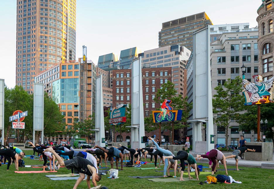
Name and Location: The Rose Kennedy Greenway is located along a mile-plus urban ribbon where the former I-93 previously scarred central Boston after depressing that stretch of highway underground in 2008.
History and Significance: Transformed green space reclaiming Surface Road land reconnects downtown to North End, featuring gardens, plazas, play spaces and art installations dedicated to the influential Kennedy family matriarch along bustling above-highway pedestrian corridors.
What to Expect: Locals and tourists traverse tree-lined paths through Dewey Square, the Carousel meadow or Chin Park zone; appreciating native flora habitats while accessing key attractions or discovering unique perspectives on familiar Boston sights from new angles.
Visitor Information: As linear public parks, Greenway areas stay open daily without restrictions. Some sections may have seasonal hours based on amenities. Easy MBTA transit access via surface stops.
Once an unsightly overhead highway, this contemporary linear park now connects key Boston neighborhoods with gardens, plazas, art exhibits and fountains perfect for city strolling. Food trucks and Zumix outdoor concerts amp up the energy on summer days across its 1.5 miles spanning Chinatown to the North End.
Special events happen weekly so check online calendars to join free yoga flows, craft workshops or swing dance parties along your route.
Charles River Esplanade
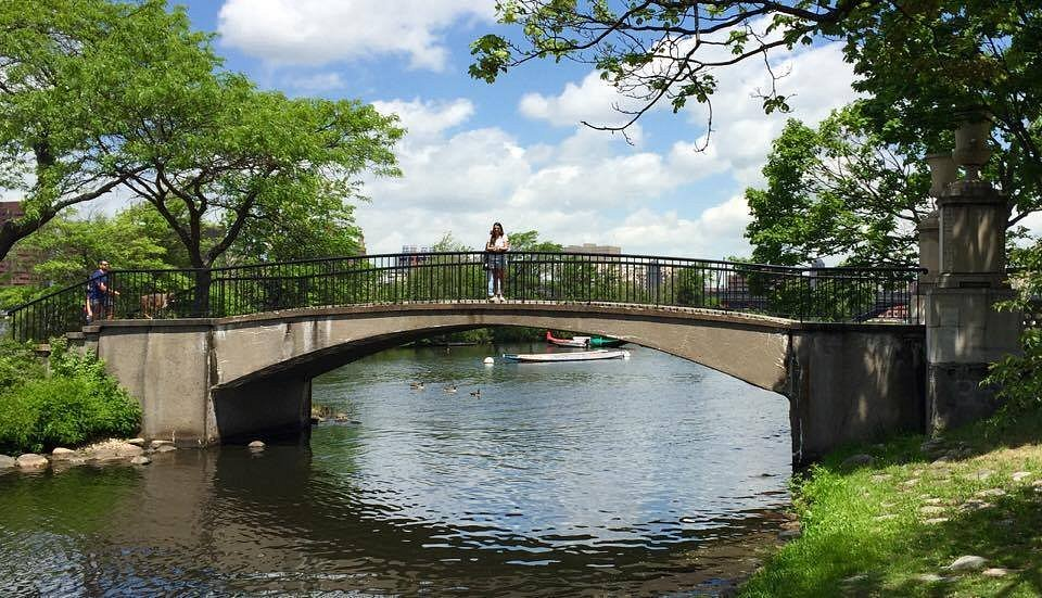
Name and Location: The Charles River Esplanade parkland follows along the southern Boston bank of the Charles River Basin between the Museum of Science area and Boston University Bridge.
History and Significance: Constructed piecemeal alongside historic urban planning initiatives over the past century, today the Esplanade connects residents to cultivate green space for recreation and relaxation along the iconic winding waters.
What to Expect: Visitors walk, run, bike or relax along its 3 miles of paved riverside trails and tree-dotted landscape, enjoying playgrounds, public art, summer concerts at the Hatch Shell bandshell and seasonal boating excursions around the Basin.
Visitor Information: As a large public park space, the Esplanade stays open daily without restrictions. Several MBTA Red Line stops nearby around Beacon Hill and Back Bay.
Stretching along Boston’s iconic Charles River, the Esplanade packs scenic riverfront trails with views of world-famous university crews prepping for regattas. Bikers, joggers and walkers flock here to log miles on dedicated lanes like the 11⁄2 mile Paul Dudley White Path dotted with public art.
Don’t miss ascending the stone steps of the Edward J. Harrington Memorial Duck House overlooking the Back Bay either. Come sunset for memorable views of Beacon Hill and the cityscape reflecting off the river too.
Castle Island
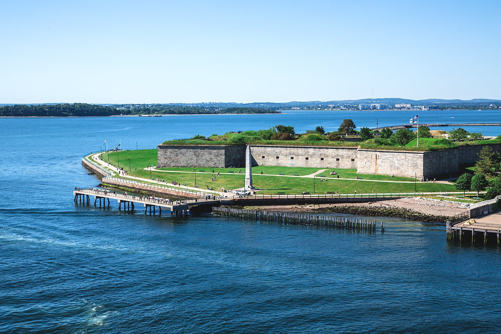
Name and Location: Castle Island refers to the 22-acre waterfront recreation site at the southeast end of South Boston affording views of Boston Harbor, accessed via Castle Island Road just off Day Boulevard.
History and Significance: Used militarily as early as 1634, today’s public peninsula park retains the name despite the actual castle structure being demolished, offering access to beach, trails and green space with rich history.
What to Expect: Visitors explore Fort Independence or walk the short beach and paths around the island perimeter while taking in scenic vistas across Pleasure Bay toward downtown and Logan Airport’s busy runways hovering over the waterfront on clear days.
Visitor Information: Castle Island stays open daily year-round 5am-midnight with some seasonal concessions. Paid parking lot onsite plus nearby MBTA Red Line JFK/UMass Station access.
Escaping city crowds is easy at South Boston’s beloved 22-acre Castle Island Park and recreation area. Walk, cycle or jog the nearly two-mile trail encircling Pleasure Bay for phenomenal views of downtown and shore birds soaring around the abandoned fort.
Take a detour down to the beaches rimming the pocket peninsula to sink your toes in the sand and cool bay waters on hot days before grabbing seafood along the harbor piers nearby.
Larz Anderson Park
Name and Location: Larz Anderson Park sits on the former Larz Anderson estate spanning 64 acres in Brookline, MA bordering the banks of Jamaica Pond with park entrances off Avon Street and Newton Street.
History and Significance: Donated to the public after Ambassador Larz Anderson’s death, the sprawling property became one of Greater Boston’s most beloved recreational spaces, retaining early 20th century Beaux-Arts landscape architecture surrounding the grand manor now serving as a metropolitan museum.
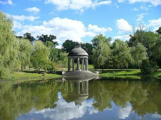
What to Expect: Visitors explore manicured park lawns linked by walking paths forgotten once inside while admiring pond views, visiting small landmarks like a one-room Japanese tea house or Italianate garden folly from vistas overlooking the water’s edge below.
Visitor Information: Park grounds open daily without restrictions. The Larz Anderson Auto Museum operates within the mansion with ticketing/hours. Some street parking available around park perimeter.
Through every season, Larz Anderson Park atop Avon Hill provides 64 acres of natural respite with outlooks from tree-framed lawns over the city thanks to its elevation. Kids especially love exploring its sprawling hillside playground while history buffs wander theоп stately terraces and Italianate gardens surrounding Larz Anderson Auto Museum.
Pack a snack then snag a picnic table along Willow Pond to take in the idyllic scenery too – it looks like a painting!
Jamaica Pond

Name and Location: Jamaica Pond occupies over 60 acres within a state park reservation in the Jamaica Plain neighborhood of Boston, with park entrances off Jamaicaway road circling its perimeter.
History and Significance: Originally part of Frederick Law Olmsted’s Emerald Necklace park system initiative developed during the late 19th century, today this kettlehole pond and surrounding parkland serves as an important natural oasis and recreation hub within the city.
What to Expect: Visitors walk, jog or bike Jamaica Pond’s 1.5 mile loop trail encircling the tranquil freshwater lake, observing boaters, geese, and other wildlife while enjoying this restorative urban greenspace.
Visitor Information: As a public park, Jamaica Pond access remains open daily without restrictions or admission fees. Some street parking available around park perimeter. Easily reached via MBTA’s Orange Line too.
Spanning over 60 acres with a scenic Emerald Necklace backdrop, Jamaica Pond draws outdoor enthusiasts from rowers to anglers and hikers. Cut through the tree-lined park to circle the kettlehole pond on a 1.5 mile loop or simply find a grassy knoll or lakeside bench to relax with a book for hours.
Keep eyes peeled for vibrant migratory birds stopping over especially in spring and fall.
Commonwealth Avenue Mall
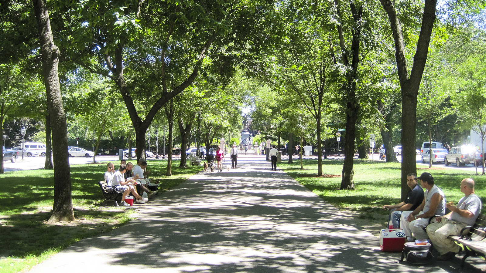
Name and Location: The Commonwealth Avenue Mall refers to the elegant green linear park spanning the center median of Commonwealth Ave through Boston’s Back Bay area between the Public Garden and Kenmore Square.
History and Significance: Envisioned as an attractive landscaped pedestrian spine tying together Back Bay, the tree-lined Commonwealth Ave Mall park developed through the late 19th century following initial green median planning by Arthur Gilman showcasing stately civic architecture.
What to Expect: Strollers admire towering elm trees and seasonal garden displays lining the central grass panels separating directional city thoroughfares, lounging on iron & wood benches under sculptural statues honoring Washington and other leaders.
Visitor Information: This park median stays open to public access without restrictions as part of the avenue itself. Close proximity to Back Bay MBTA station and public parking garages around Newbury St.
Back Bay’s gorgeous Commonwealth Avenue Mall ranks as the grandest parkway in Boston’s famed Emerald Necklace system. The greenway connects the Public Garden to Back Bay Fens with a central grassy mall dotted by statues of historical figures like senator Henry Cabot Lodge and pioneer Samuel Eliot Morison.
Join joggers on tree-shaded sidewalks then find a bench near the central fountain to admire brownstone architecture bookending the idyllic refuge from city bustle.
Conclusion
From downtown gardens and river trails to beaches, nature preserves and sprawling recreation areas, Boston offers seemingly endless outdoor escapes across its parks network perfect for replenishing body and spirit. Use this round up of top picks as your launchpad to uncover new favorite green spaces spanning history, foliage and scenic skyline views unique to Beantown.



Join the Conversation